From visual evidence to better work management

Quick Summary
How reality capture improves planning, productivity, troubleshooting and operational performance
Reality capture creates value when it changes how people work. A scan that no one opens does not improve operations. A 360-degree walkthrough that cannot be found does not help a technician. A drone map that stays in a construction archive does not reduce future risk. A point cloud that is too heavy for everyday users may be useful for design but invisible to the maintenance team.
The value is not the capture itself. The value is better decisions inside the work process. That is where construction reality capture can become operational intelligence.
The business problem: maintenance work often starts without enough context
Facility work often begins with uncertainty. The technician receives a work order but does not know exactly what the space looks like. The planner does not know whether a ladder, lift, escort, shutdown, permit or special tool is required. The contractor does not know what is above the ceiling. The engineer does not know whether the replacement equipment will fit. The reliability team does not know whether a recurring issue is caused by the asset, the installation, the environment, access constraints or a hidden defect.
This uncertainty creates wasted time. People walk the site to gather information. They make a first trip to diagnose and a second trip to repair. They wait for clarification. They order the wrong parts. They arrive without the right lift. They discover access constraints too late. They open ceilings to verify conditions. They escalate issues that could have been screened earlier.
The result is lower wrench time, weaker planning, schedule interruptions, greater risk and more frustration for the people doing the work. An operational memory layer can change that.
What visual evidence adds to work management
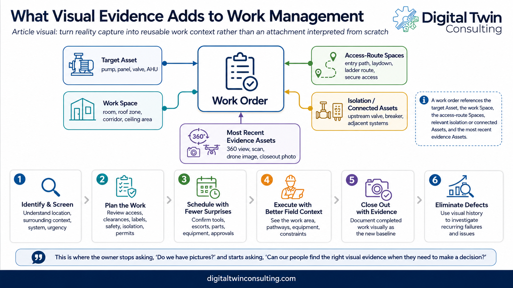
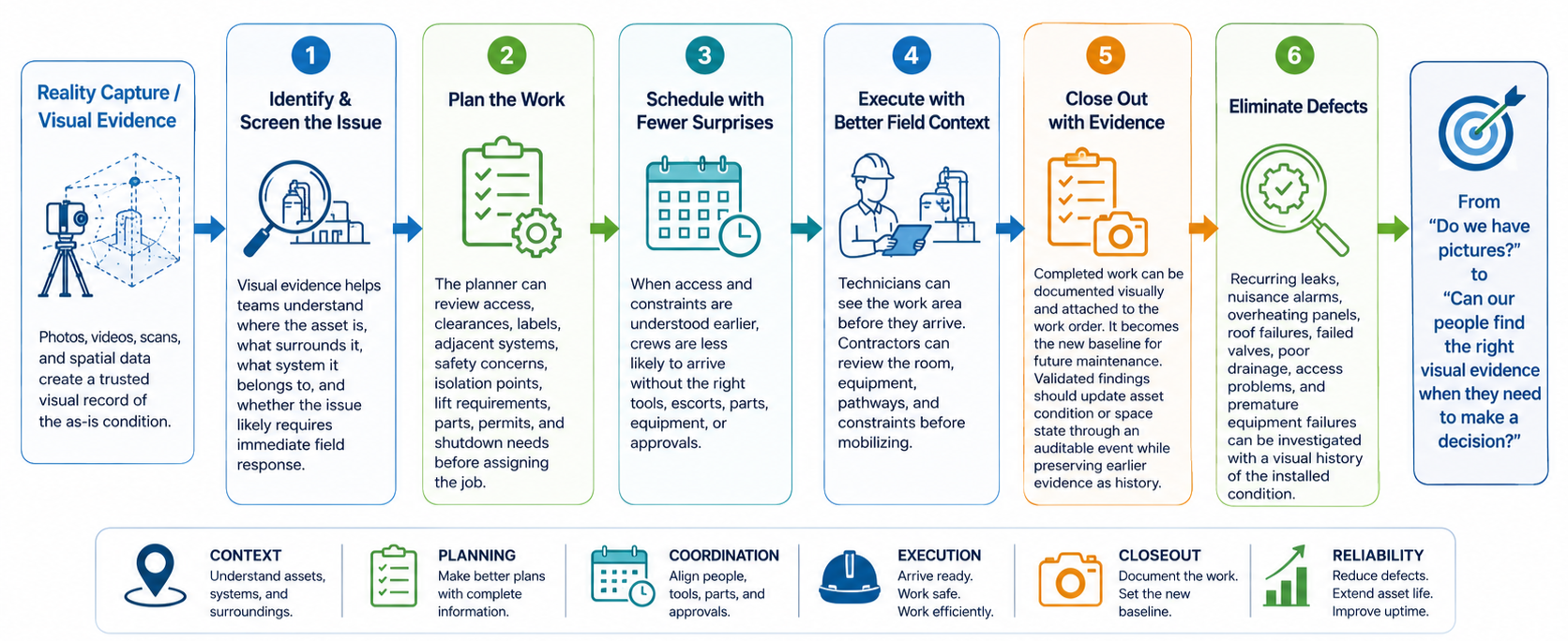
Effective reliability and maintenance work management depends on accurate issue identification and screening, detailed work plans, coordinated schedules, quality execution, contextualized closeout records and defect elimination. Reality capture can support each step.
Identify and screen the issue
Visual evidence helps teams understand where the asset is, what surrounds it, what system it belongs to and whether the issue is likely to require immediate field response.
Plan the work
The planner can review access, clearances, labels, adjacent systems, safety concerns, isolation points, lift requirements, parts, permits and shutdown needs before assigning the job.
Schedule with fewer surprises
When access and constraints are understood earlier, crews are less likely to arrive without the right tools, escorts, parts, equipment or approvals.
Execute with better field context
Technicians can see the work area before they arrive. Contractors can review the room, equipment, pathways and constraints before mobilizing.
Close out with evidence
Completed work can be documented visually and attached to the work order. That becomes the new baseline for future maintenance. Validated findings should update authoritative asset condition or space state through an auditable event, while preserving earlier visual evidence as history.
Eliminate defects
Recurring leaks, nuisance alarms, overheating panels, roof failures, failed valves, poor drainage, access problems and premature equipment failures can be investigated with a visual history of the installed condition.
This is where the owner stops asking, “Do we have pictures?” and starts asking, “Can our people find the right visual evidence when they need to make a decision?”
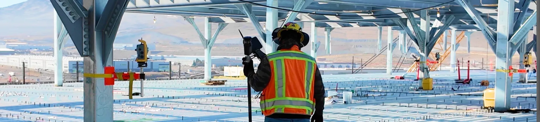
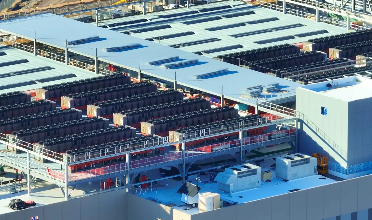
See reality capture in action on a live data center project:
Match the capture method to the work decision
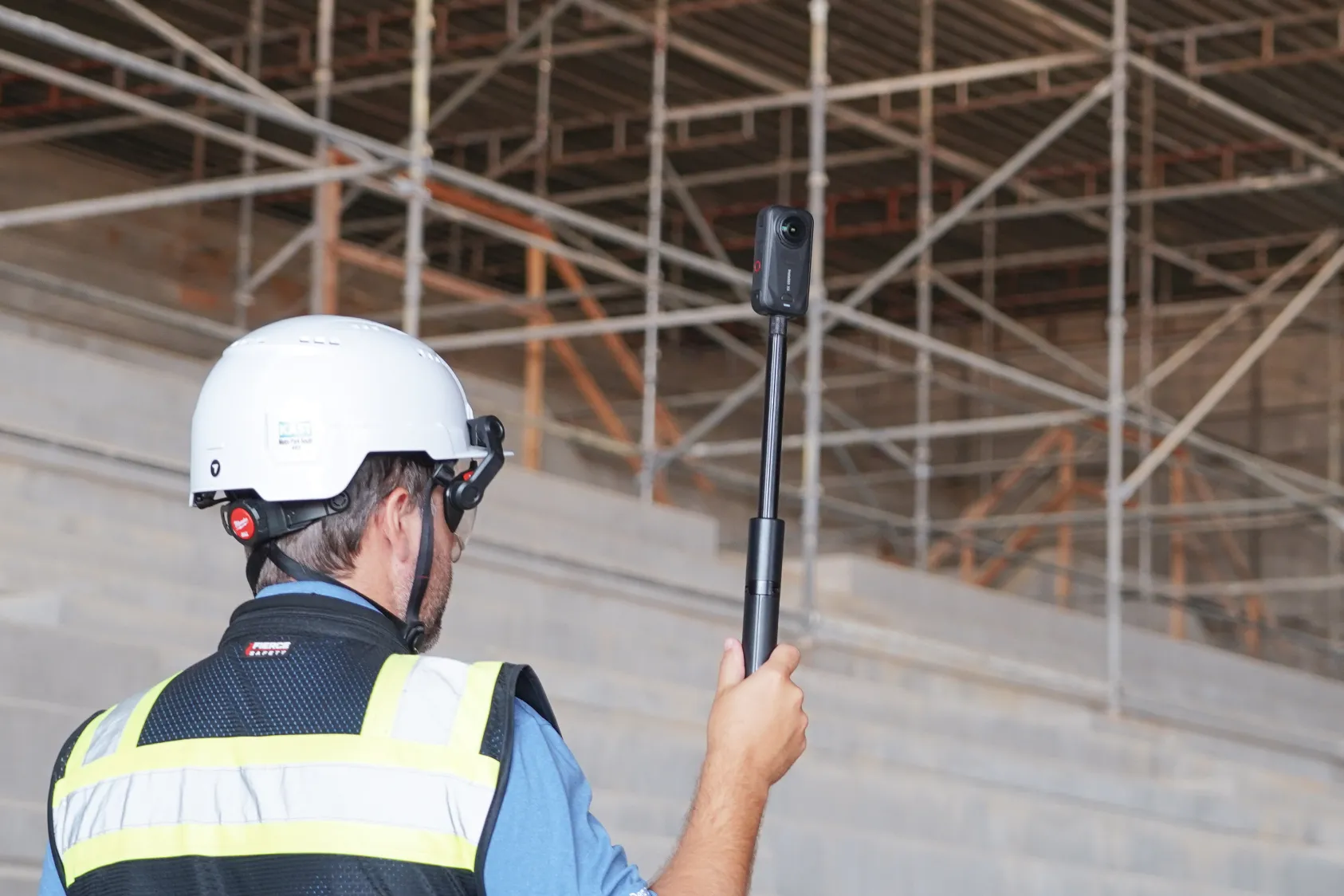
Not every use case requires the same fidelity. A facility operator may not need a highly accurate engineering point cloud for everyday work. They may need clear, easy-to-open 360-degree imagery that lets them read valve tags, asset tags, equipment labels, panel names, pipe flow arrows, damper positions, manufacturer plates, safety notes and what is connected to what.
Users are also more likely to trust a recent capture because the space is less likely to have changed. Better still is a trusted program that gives users confidence that any subsequent change has been documented and approved.
The capture toolbox in simple terms
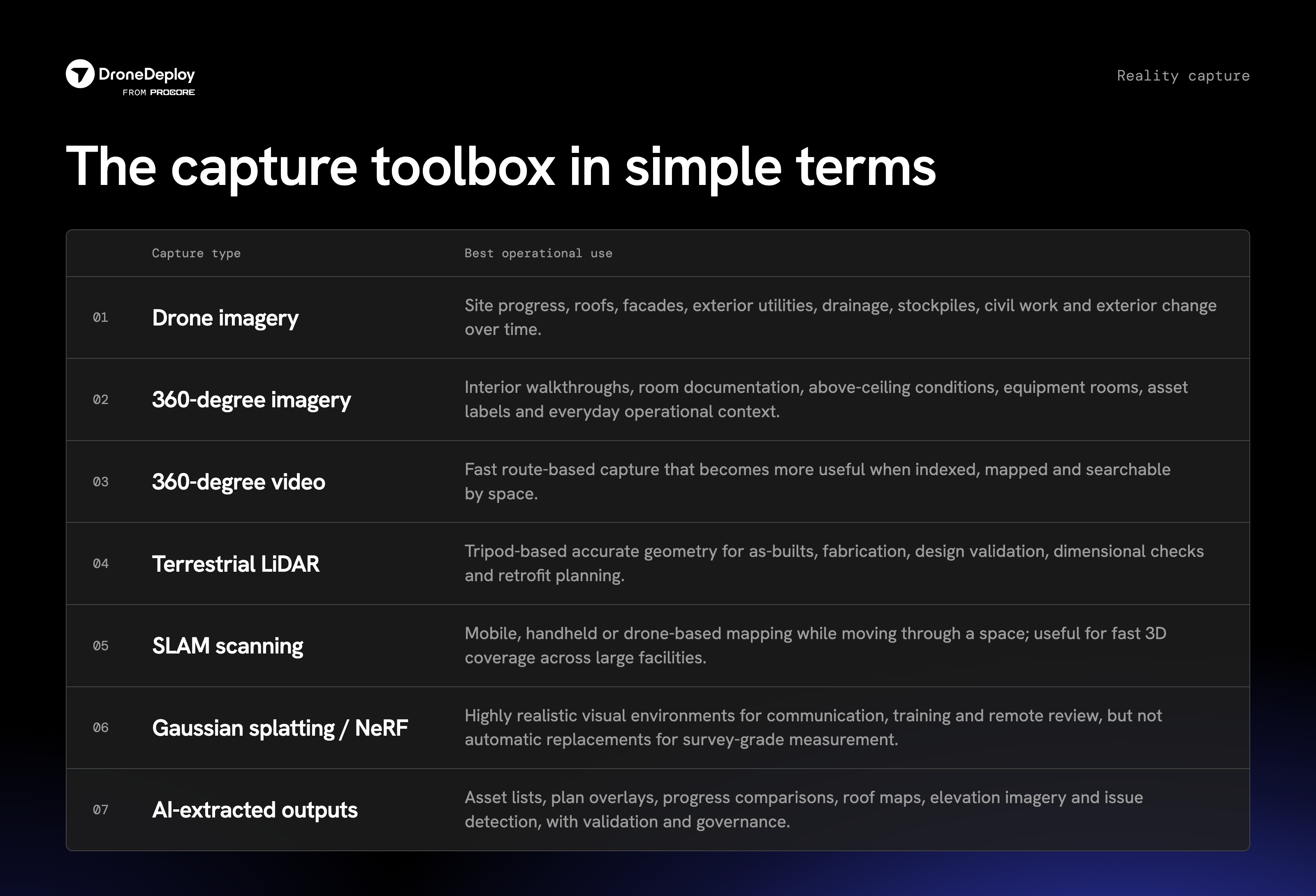
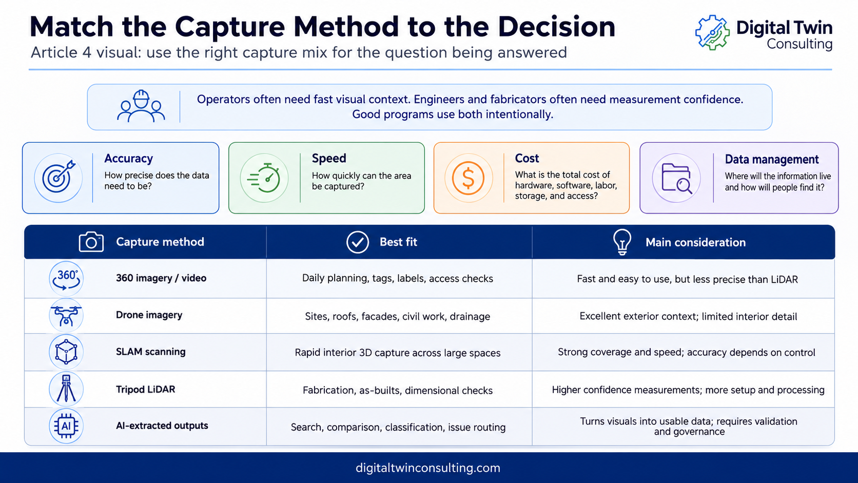
The best strategy is intentional. Some use cases need 360-degree imagery. Some need drone image maps. Some need SLAM scanning. Some need terrestrial LiDAR. Some need all of the above at different points in the lifecycle.
The question is not, “Which technology is best?”
The question is, “Which capture method best supports the decisions we need to make and which stakeholders are involved in solving the underlying business problem?”
Considerations:
For design, fabrication, coordination or retrofit work, the requirements change. If an engineer needs to confirm whether a new piece of equipment will fit through a doorway, whether a replacement pump has enough clearance, whether a pipe rack has room for another line or whether fabrication spools will align with installed conditions, LiDAR becomes much more important.
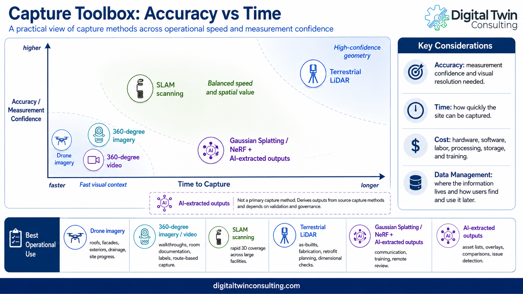
Accuracy: How precise does the data need to be? A maintenance planner may need visual context. A fabricator may need dimensional confidence. A surveyor may need control. Accuracy may also include sufficient visual resolution to read a tag or support an outcome, such as a machine-learning model identifying anomalies or defects.
Time: How quickly can the site be captured? Drone imagery, 360-degree walkthroughs and SLAM scanning can cover large areas quickly. Tripod LiDAR may take longer but produce higher-confidence measurements.
Cost: What is the total cost of hardware, software, field labor, processing, storage, training and long-term access? A lower-cost method used consistently may be more valuable than an expensive scan performed once and never used.
Data management: Where will the information live? How will users find it later? Can it connect to BIM, GIS, CMMS/EAM, asset management, commissioning records, work orders or digital twin platforms?
A practical capture strategy balances accuracy, time, cost, and data management. Accuracy includes measurement confidence and visual resolution. Time includes how quickly the site can be captured. Cost includes hardware, software, labor, processing, storage, training, and long-term access. Data management includes where the information lives and how users find it later.
Make the data AI-ready and work-order-ready
The next wave of value comes from connecting visual evidence to operational systems. Imagine a planner asking a system to show all visual records of a valve, the surrounding piping, the related work history, the last inspection, the room space, and the safest access path. Imagine a technician opening a work order and seeing the exact asset, tags, isolation points, ceiling conditions and recent closeout photos.
This is about giving people better context before they act and using agentic workflows to automate repetitive, time-consuming tasks.
Imagine a capital planner asking for the visual history of a roof area before approving a repair. Imagine a commissioning agent comparing functional test results against installed conditions.
To make that possible, visual data needs relationships. It needs space, asset references, dates, system context, permissions, governance and enough currency for the decisions it supports.
A small consistent vocabulary makes retrieval and automation more reliable: asset contained in space, space contains asset, space is adjacent to or connected to another space, asset connected to or depends on another asset, evidence depicts asset or space, and observation is about an asset or space.
What to do next
Choose one work process such as a roof leak, above-ceiling maintenance task, electrical room inspection or valve repair. Test whether visual evidence reduces planning time, repeat trips, safety uncertainty or field clarification.
Key takeaways
- Visual evidence becomes valuable when it changes planning, scheduling, execution, closeout and defect elimination.
- Work orders should reference the target asset, work space, access-route spaces, isolation or connected assets, and the most recent relevant evidence.
- Different work decisions require different capture methods and accuracy levels.
- AI-ready and work-order-ready data requires relationships, more than images or scans.
- The goal is better work rather than more files.
Continue the series
Part of the five-part series Reality Capture as Operational Memory. Read the other articles:
- Part one: Don't let reality capture die at handover
- Part two: Plan reality capture backward from operations
- Part three: Capture it before it disappears
- Part five: From a reality capture data fabric to an operational digital twin (coming soon)
About the author

Kelly Watt is a digital transformation leader specializing in digital twin technology for aviation, data centers, smart cities, oil and gas and critical infrastructure.
Kelly is the Co-Founder of Digital Twin Consulting. The firm delivers strategic master planning and the proprietary DTAP assessment process to digital transformation projects worldwide.
A frequent collaborator with Georgia Institute of Technology, University of Texas at Dallas and Mohawk College, Kelly focuses on practical digital transformation: strategy before technology, value before complexity and adoption before dashboards.

FAQ
It gives crews context before they act. A planner can check access, clearances, and isolation points, order the right parts, and avoid a wasted first trip, because the space was documented and is searchable against the asset and work order.
High-resolution 360-degree imagery (DroneDeploy Ground) is usually best for reading valve tags, panel names, and flow arrows. LiDAR (Ground Pro) is better when you need dimensional confidence for fit, clearance, or fabrication.
Ready to learn more?
Contact sales to see how DroneDeploy can give your teams the power to document and analyze your sites from the air and ground – all in one AI-powered platform.