What's new in DroneDeploy: July 2026 quarterly release
.svg)

Quick Summary
See what's new in DroneDeploy's July 2026 release, from the new Ground mobile app to Aerial Pro at 2x the speed and Progress AI schedule matching.
Four major advancements to remember from this release:
- Aerial Pro is now 2x faster, 2x denser and more accurate, with upgraded volumetrics for heavy civil and earthworks customers.
- The new version of the Ground App unlocks field inspections, with voice-dictated Field Notes, 2-way Procore and Autodesk sync, plus 3D Walks and RTK 3D scans with Ground Pro.
- Progress AI keeps your project on track, with new schedule matching, deviation reports, P6 import and AI chat.
- Meet our friendly new robotic Capture Agent – capturing at a project near you.
For the complete list of features, and availability notes, see the release detail below:
1. Aerial Pro – 2x faster, 2x denser, more accurate
Available now
Up to 2x faster processing. Aerial Pro now processes large datasets up to 2x faster than standard mode. A 300-image map is ready in under an hour, and a 1,500-image megaproject map arrives in under 3 hours. Fly in the morning, put a controlled map in the superintendent’s hands the same day.
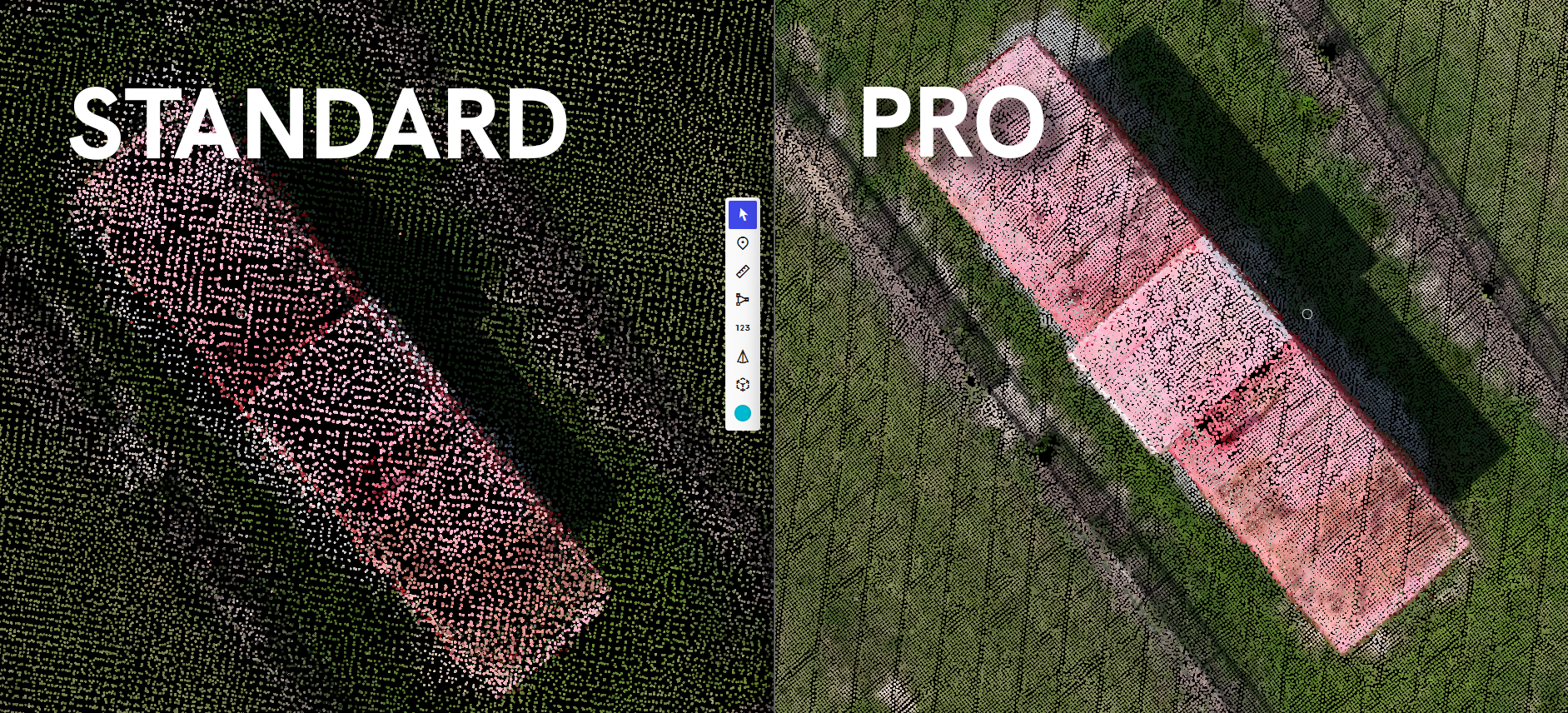
2x denser 3D outputs. All that speed comes with more detail, not less. Aerial Pro produces 2x more 3D points than the standard pipeline on a 1,500-image map, and up to 10x more on the largest sites. Richer 3D detail means higher volumetric accuracy where it matters.
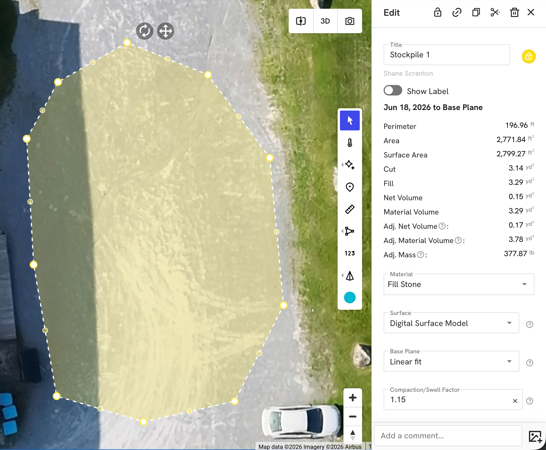
Compaction and swell factor. Stockpile volumes often have to reconcile with estimates that assume loose or compacted material. You can now apply a compaction or swell factor directly on a volume annotation, and the adjusted values carry into your CSV report exports. Quantities become trustworthy and defensible.
Upgraded measurement system. Every volumetric measurement now computes more precisely in your project’s CRS, polygons report perimeter length, and a cleaner interface with one-click copy makes numbers easier to read and reuse.
Aerial: Dock Reliability
Available now
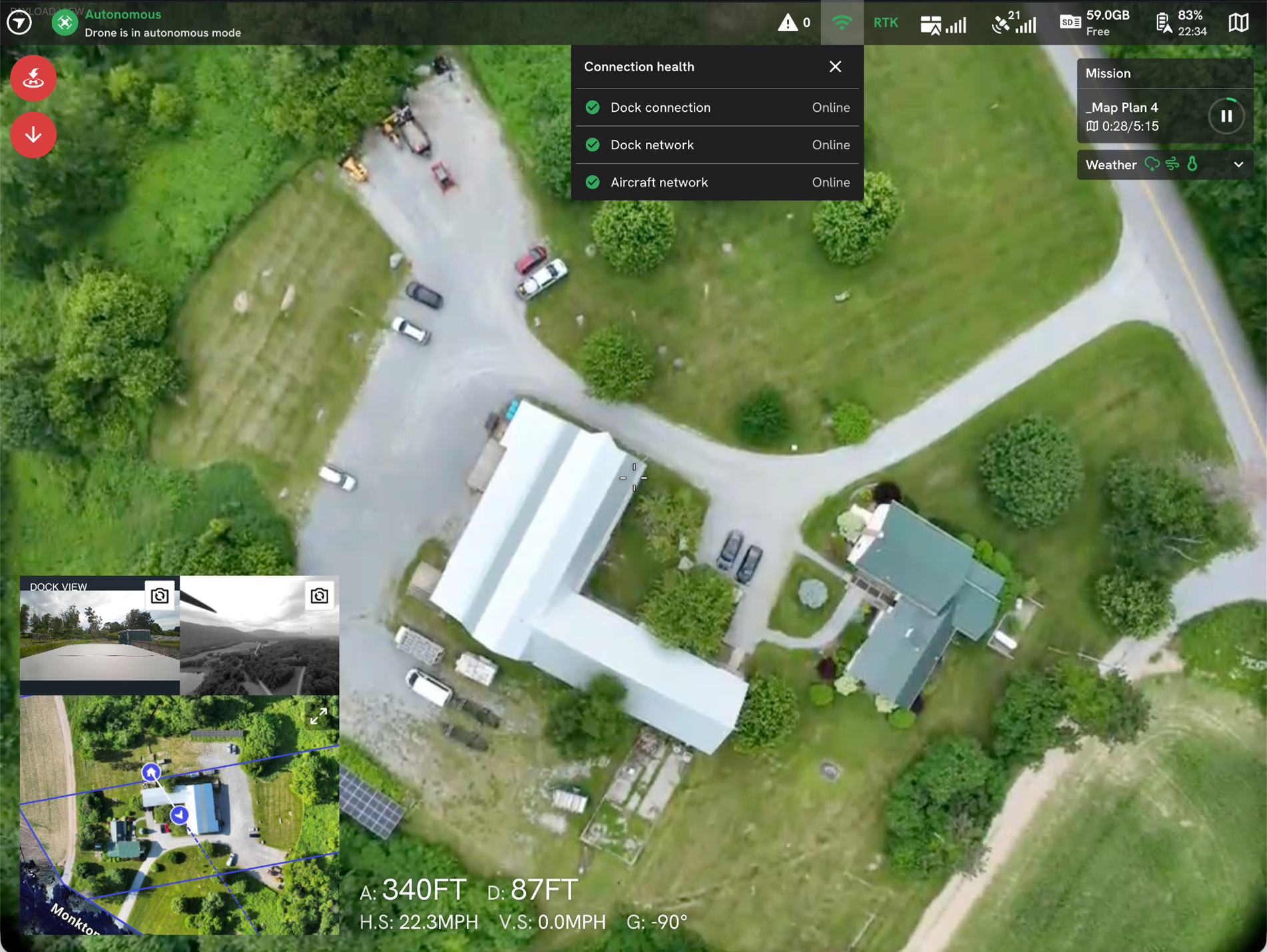
One more thing for teams flying docks. New upload infrastructure brings Dock upload success to 99.9%, and a connection health panel shows the state of your dock, drone and network during remote operations.
2. Ground: field inspections unlocked
Available now
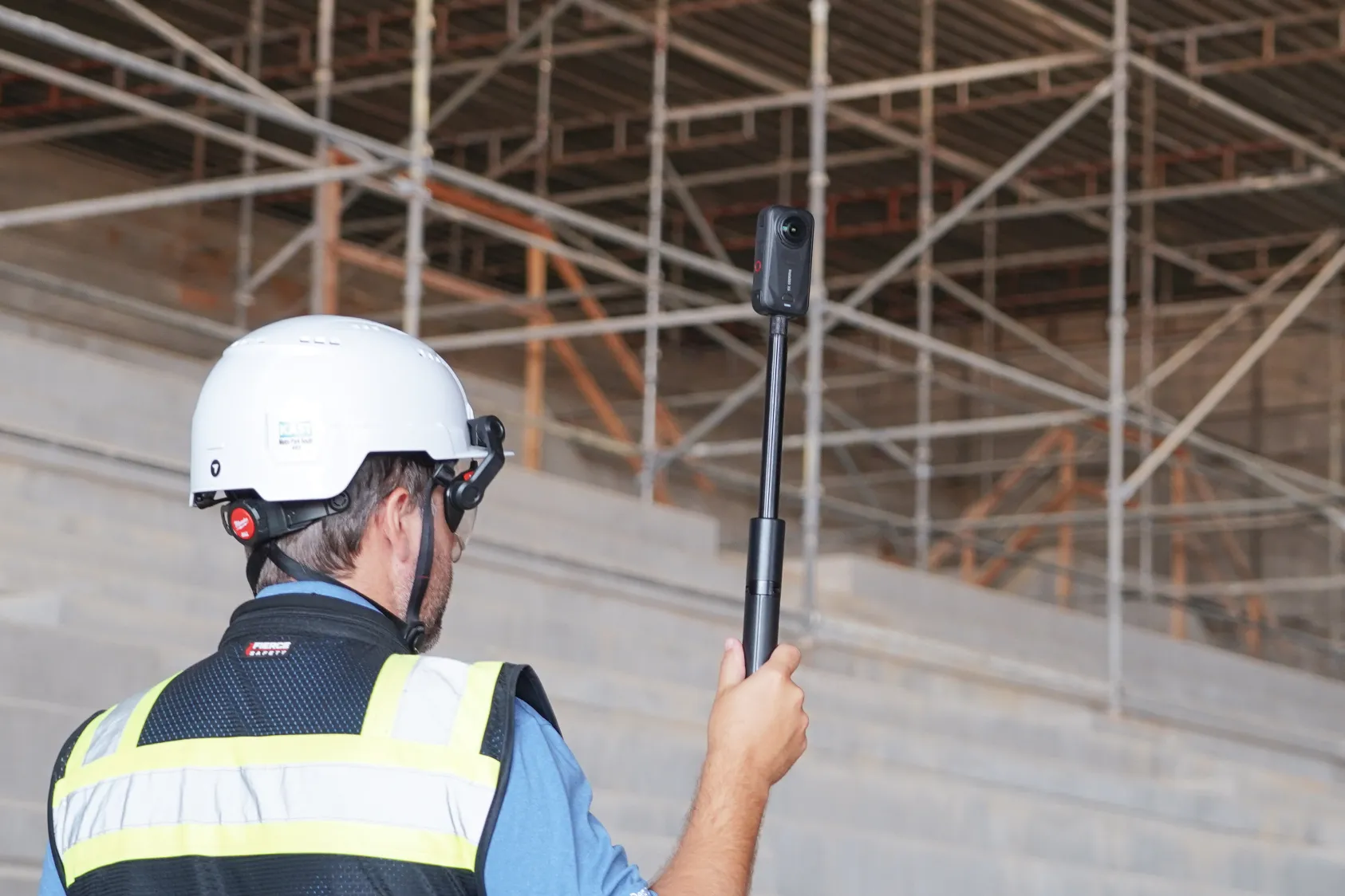
This is the app version you’ve been waiting for. The new Ground app turns a routine site walk into an inspection workflow, without slowing down the Walk.
Field Notes with voice dictation. When you capture a photo or pano, the app prompts you to attach a field note. Dictate it out loud and keep moving. Add context exactly where you see the observation, without stopping the Walk.
2-way sync with Procore and Autodesk. Field notes sync both ways with Procore and Autodesk. Push a note for your team to pick up in the system they already use, no DroneDeploy access required. When they resolve it there, the change flows back to your DroneDeploy project. Field to office, and back again.
DXF overlays on mobile. View your design files right on top of your latest map, out in the field where that information is most useful. CAD lines render in their original colors, opening up QA/QC and design review on mobile.
Camera connection that works like your earbuds. The app now detects your camera automatically. Power it on, tap once, and you’re capturing. Connection is twice as fast as before.
Photos from your camera roll. Grab a quick shot with your phone’s camera mid-task, then keep walking. You can now add those photos to DroneDeploy straight from your camera roll. If you caught our Spring Customer Appreciation release, you saw this one land alongside movable media pins and the redesigned map pins.
Set-and-forget BIM alignment. A guided setup walks you through aligning your first model, with a snap-to top-down view and a check that keeps misalignments from slipping through. Every model you add afterward inherits that alignment automatically. Do it once and stop thinking about it.
And with Ground Pro: 3D for every project
Availability Status: Early Access
Ground Pro adds a 3D layer to the same walks your team already does.
3D Walks are now higher quality with improved measurement accuracy. Verify measurements after the walls close, without sending someone back to the site.
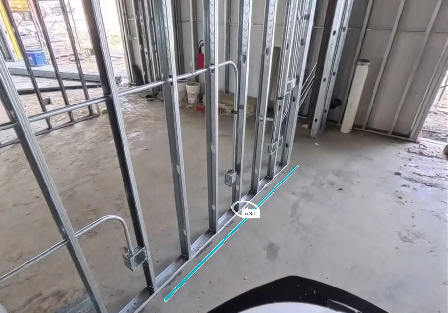
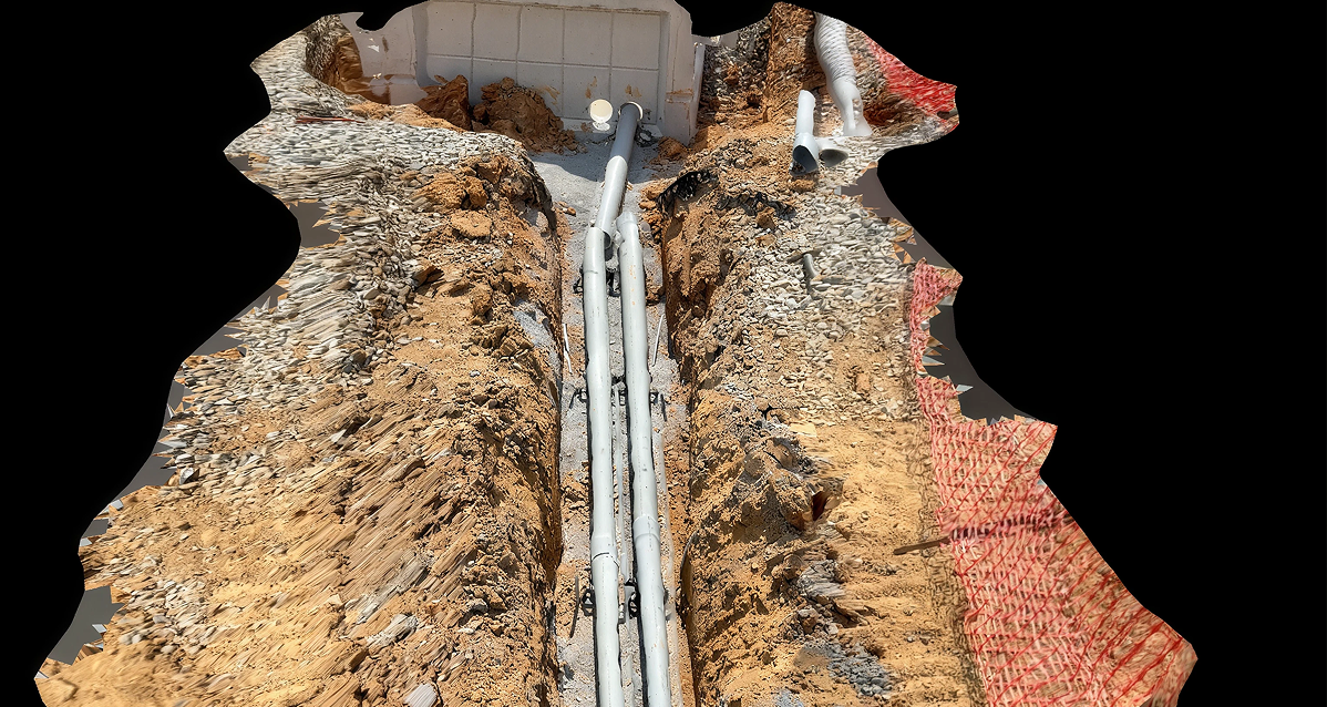
Mobile 3D Scan with RTK brings survey-grade positioning to a handheld scan. Early results scanning trenches are strong, in line with the accuracy you get from an aerial RTK map. Scan trenches, in-slab sleeves, facade patches and object-sized conditions, all before backfill.
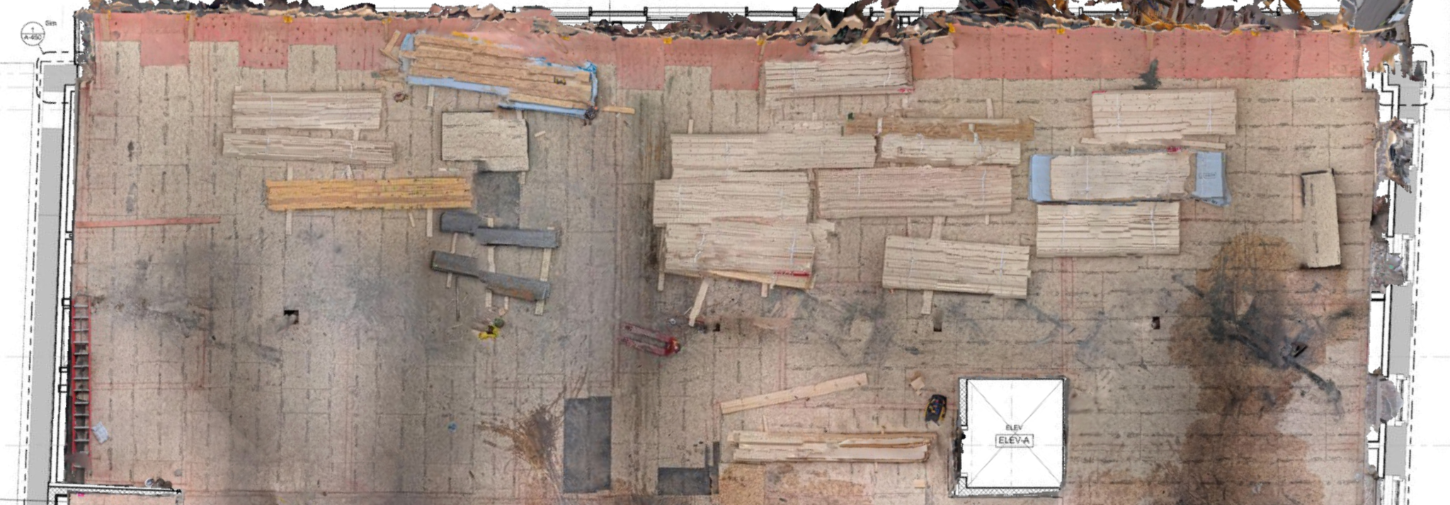
Floors and ceilings are crisper and easier to read. From your latest walkthrough, sequence trades, review material laydown and confirm overhead work in place.
3. Progress AI: keep your project on track
Availability Status: Early Access
Progress AI reads your reality capture and turns it into schedule truth. This quarter it learned to speak P6.
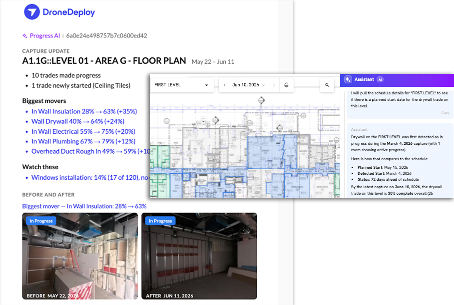
Automatic schedule actuals. Upload your P6 schedule and watch detected start and end dates populate automatically, minutes after photos are uploaded. The timeline view aligns with your schedule hierarchy and activity IDs, so actuals appear in the structure and language of your original schedule. Drill down for granular detail.
Schedule deviation reports, including quantities. A customizable report shows detected versus planned start and end dates, and quantity installed versus expected, per activity. When you need the data back in planning tools, export an actualized XER, your schedule in P6-readable format augmented with Progress AI actuals.
Progress trends and summaries. Report on the entire project, a single trade or a level. What progress have we seen these past few weeks, and which trades are tracking to plan?
AI chat and morning reports. Ask trade coordination questions like “Where can we start wall painting on Level 1?” or “When are drywallers tracking to finish in Area A?” and get an answer with a click. Quantified progress arrives in your inbox every morning, with capture summaries that surface potential stalls or milestones and deep links back to the supporting reality data. And with the Progress AI MCP, you can answer progress questions from Procore, Outbuild, Copilot, Claude and more.
4. Meet our friendly new robotic Capture Agent
Availability Status: Early Access
Capture Agent is robotics as a service for daily interior capture. An autonomous ground robot navigates using only your construction drawings, guided by a dataset of human-captured walkthroughs.
It captures every requested area on a recurring schedule, usually after hours when crews are done working. Every capture uploads to your DroneDeploy project, giving you consistent data that feeds Progress AI and your other downstream workflows.
DroneDeploy delivers the whole package as a white-glove service. We provide all the infrastructure to support the robot, including a proprietary radio network, in one inclusive package backed by an SLA. Your team gets the daily record without the daily walk.
The highlights
The four things worth remembering, one more time.
- Aerial Pro is now 2x faster, 2x denser and even more accurate, with upgraded volumetrics for heavy civil and earthworks.
- The new Ground app unlocks field inspections, with voice-dictated Field Notes, 2-way Procore and Autodesk sync, plus 3D Walks and RTK 3D scans with Ground Pro.
- Progress AI keeps your project on track, with new schedule matching, deviation reports, P6 import and AI chat.
- Meet our friendly new robotic Capture Agent – capturing at a project near you.
Interested in learning more about this release? Contact your account team.
Stay up to date on product releases and announcements: Sign up for our newsletter
.png)
FAQ
Ready to learn more?
Contact sales to see how DroneDeploy can give your teams the power to document and analyze your sites from the air and ground – all in one AI-powered platform.