What 360 Reality Capture Shows That Static Photos Miss
.svg)
Quick Summary
360 reality capture uses 360-degree cameras to record site conditions during routine walks, with AI software automatically mapping imagery to floor plans or BIM models. The result is a navigable visual record that teams reference for progress tracking, inspections and documentation throughout a project's lifecycle.
Static photos capture one angle. 360 reality capture records every direction at once. It creates a navigable visual record that teams reference long after the work moves on.
This difference changes how teams document and revisit site conditions throughout a project.
This guide covers how 360 cameras capture construction sites and what the process looks like in practice. It also covers how teams use the resulting documentation for progress tracking, remote visibility and QA/QC.
.jpg)
What static site photos actually miss
You've probably been there before, dealing with photos that don't capture what you actually need. Someone snaps a photo, drops it in a folder and moves on. Three weeks later, a question comes up about what was behind that wall or to the left of the frame.
The photo offers no answers. Static photos show one angle, one moment, with no view of surrounding conditions. If you want to see what was installed on the opposite wall, you either find another photo or make another trip to site.
The other issue is location. Photos often end up disconnected from floor plans, organized by date or trade but not by where they were taken. Retrieving the right image means scrolling through folders and hoping the file name jogs your memory.
Here's what typically gets lost with static photos. These gaps show up repeatedly across projects and create real problems when questions arise later:
- Spatial context: No view of surrounding conditions or adjacent work
- Location mapping: Photos disconnected from floor plans or site drawings
- Consistent viewpoints: No way to capture the same angle on repeat visits
See 360 walks in action:
What 360 reality capture shows on a construction site
360 reality capture is a method of documenting site conditions using 360-degree cameras that record every direction at once. As you walk a site, the camera captures panoramic images. Viewers can navigate these after the fact, looking up, down and around from each capture point.
This approach creates a complete visual record rather than isolated snapshots. Platforms like DroneDeploy process the captures and map them to floor plans automatically, creating a navigable visual record rather than a folder of files.
Full spatial context in every direction
With a 360 capture, you can look in any direction from a single point. If a question comes up about what was installed on an adjacent wall, you pull up the capture and pan over to see it. You avoid return trips to site and don't have to hope someone took a second photo from a different angle.
Location-mapped documentation
AI software maps each 360 photo to your floor plan or BIM model based on where the camera traveled. This process is sometimes called photo mapping. You click a point on the plan and see the 360 view from that exact location, on any date you captured.
Timestamped visual history
Every capture gets tagged with date and location. Over time, this builds a chronological record of how each space changed. When questions come up about prior conditions, you have a reference point that holds up.
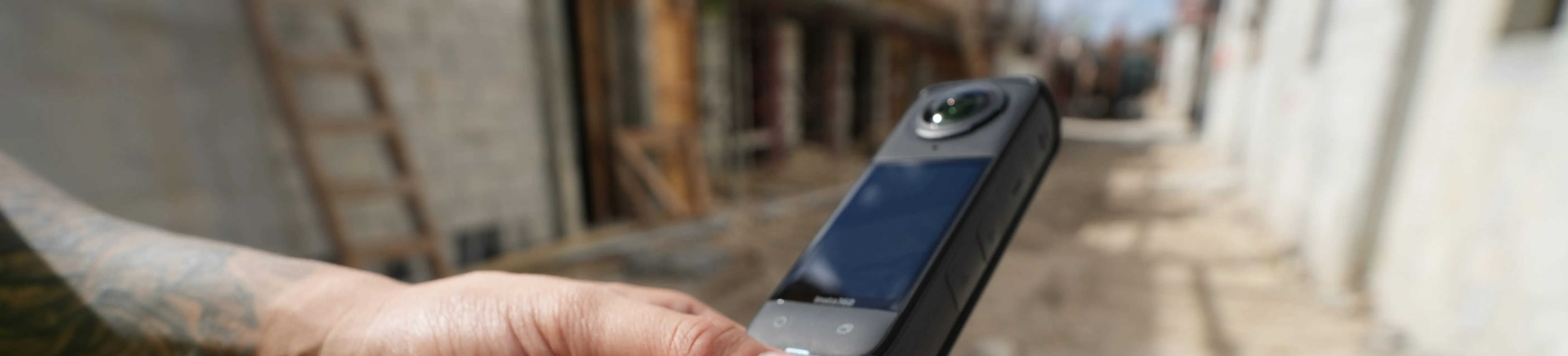
How 360 cameras capture a construction site
The physical process is straightforward. You mount a 360 camera on a hard hat or selfie stick and walk your normal route. The camera records continuously while you move, capturing everything around you without stopping to frame shots.
Mounted rigs and handheld capture
Most teams mount the camera on a hard hat clip or chest harness. Some prefer a handheld selfie stick for tighter spaces. Keeping the camera steady and unobstructed improves output quality, though the process fits into a routine site walk without adding extra steps.
Video walks and photo tours
360 cameras can record continuous video or capture photos at set intervals. Video gets processed into discrete frames, while photo tours capture at fixed distances or times. Either approach produces a walkable record of the space.
Processing and viewing captured data
After capture, files upload to a platform where software stitches the imagery and maps it to your drawings. The output is a navigable walkthrough. You click a location on the plan and see the 360 view from that spot.
Progress tracking with repeatable 360 walks
Walking the same route weekly or at key milestones creates a visual timeline. You can compare side-by-side views of the same location across different dates, which makes it easier to track what changed and when.
This consistency turns routine walks into a structured documentation process. Teams looking to automate this further can explore DroneDeploy Progress AI for automated progress reporting from 360 and drone data.
Same vantage points over time
Because the camera captures from consistent positions, you get comparable views across captures. This is useful for tracking progress on finishes, verifying installations or documenting conditions before work gets covered. The repeatability removes guesswork from progress documentation.
Automated photo mapping to site plans
The platform places each capture point on your floor plan automatically. You select a date, click a location and see the 360 view from that spot. The system eliminates manual tagging and folder organization.
Remote visibility without site visits
Stakeholders, project managers and owners can walk the site virtually from anywhere. According to McKinsey research on capital project transparency, projects overrun budgets and schedules by 30 to 45 percent on average, making real-time visibility critical. This reduces travel for routine check-ins and gives remote teams current visibility into field conditions.
When someone has a question about a specific area, they can pull up the latest capture instead of waiting for the next site visit.
.JPG)
Comparing as-built conditions to design models
360 captures support QA/QC by letting you compare what was built to what was designed. This is where the visual record becomes a reference for verifying work. Teams use these comparisons to catch discrepancies early and document compliance.
BIM overlays in 360 views
Some platforms can superimpose design models onto 360 imagery. You toggle between what you see in the capture and what the model specified, which helps identify discrepancies before they become problems. This overlay capability turns visual documentation into a verification tool.
Before and after comparisons by phase
Selecting two capture dates in the same view shows how a space changed. This is useful for pre-cover documentation, such as comparing framing or MEP rough-ins to the finished condition. The side-by-side comparison creates a clear record of progression.
.png)
Using a 360 camera for construction site documentation
Here's where 360 capture fits into typical project phases. Each phase presents different documentation needs and opportunities. The following examples show common applications across the project lifecycle.
Interior walkthroughs and finishes
Documenting framing, drywall, paint and finish work creates a record of each phase. Capturing spaces before ceilings close or walls get covered preserves visibility into what's behind the finished surface. This documentation proves valuable when questions arise months or years later.
Active work zones and coordination
360 captures document active areas where multiple trades are working. The record shows who was where and what was installed on a given date, which helps with coordination and resolving questions later. This visibility supports accountability across the project team.
Pre-cover and underground documentation
Capturing MEP rough-ins, in-wall conditions and underground utilities before they get covered creates a permanent reference. When someone asks what's behind a wall or under a slab, you have a visual record to pull up. This pre-cover documentation eliminates guesswork during future maintenance or renovations.
Choosing the right 360 degree camera for construction
Selecting a 360 camera depends on your site conditions and documentation goals. Several factors influence which camera works best for your team. The table below outlines key considerations.
- Resolution: Higher resolution captures finer detail for zooming in on specific areas
- Durability: Jobsite conditions require cameras that handle dust, bumps and weather
- Mounting options: Hard hat clips, selfie sticks or chest mounts affect capture stability
- Battery life: Longer walks require sufficient battery to complete the route
- Platform compatibility: Confirm the camera works with your documentation software
Before committing to a camera, test it on a typical walk to see how it handles your site conditions and integrates with your existing workflow. A trial run reveals compatibility issues that specs alone won't show. Most vendors offer demo units for this purpose.
Learn how to start using 360 capture on your jobsite:
One visual record from ground to air
360 ground capture fits into a broader reality capture approach. Platforms like DroneDeploy combine 360 walks with aerial drone data in one system. This integration creates a complete picture of site conditions from multiple perspectives.
Aerial, ground and design data live together, accessed through one login. Maps, models and 360 walkthroughs can be compared side by side, with design intent referenced against what's installed. This unified view eliminates the need to switch between separate systems.
Data is captured on site and referenced across the team when questions arise.
.png)
FAQ
Capture time depends on floor size, though most users walk a floor in the same time as a routine site walk. No setup or stopping is required, so the process fits into existing workflows. Most teams complete a floor in 10 to 20 minutes depending on size and complexity.
File sizes vary by camera resolution and walk length. Most platforms handle upload and compression automatically, so teams don't manage raw files directly. Typical uploads complete within minutes over standard site internet connections.
Captures work in typical jobsite conditions. Overcast or diffused lighting produces better results than harsh shadows or very dark interiors. Teams often schedule captures during morning or late afternoon hours for optimal lighting.
Platforms like DroneDeploy combine ground 360 imagery with aerial maps and models. Teams view interior and exterior data in one system. This integration provides a complete picture of site conditions from multiple perspectives.
Most crews start capturing after a brief orientation. The process is walking a route with a mounted camera, not operating specialized equipment. Field teams typically become proficient within their first few walks.


.jpg)
Ready to manage your data from the very start?
Book a quick call to see how DroneDeploy streamlines capture from construction through building ROI.