50 degrees cooler: how thermal mapping proves micro forests work
.svg)
Quick Summary
In cities shaped by decades of inequitable planning, Dr. Jeremy Hoffman is using aerial data to prove that small patches of nature can cool a neighborhood, and change what cities invest in.
The problem hiding in plain sight
On a summer afternoon in New Orleans, the stretch of asphalt beneath the I-10 overpass runs hotter than anywhere else in the neighborhood. The highway cuts through the area and leaves behind pollution and heat.
Groundwork New Orleans has been transforming a stretch of that land into something else: a storm water management park with mature shade trees, permeable surfaces, and community green space. Anyone that walks by the park could immediately feel the impact. But, that isn’t always enough. Without accessible and visual data tracking the cooling benefits of these interventions, valuable data is missing from the story.
That's what Dr. Jeremy Hoffman wants to change - how we track and communicate heat-mitigating benefits of hyper-local green infrastructure.
The person behind the proof
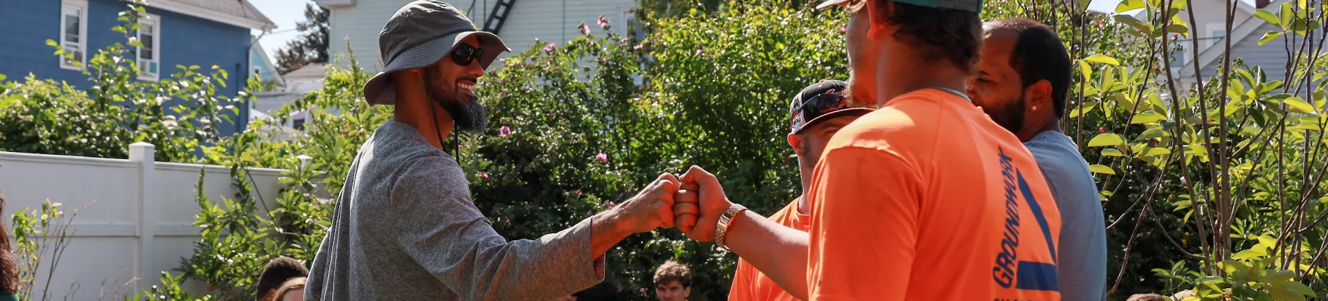
Hoffman is the Director of Impact Evaluation and Community Science at Groundwork USA, the national nonprofit that coordinates a network of 19 community-based affiliates across the country. Groundwork's mission is focused on repairing what decades of inequitable urban planning left behind: transforming neglected land into green assets, reducing extreme heat and flooding, and supporting a new generation of environmental leaders.
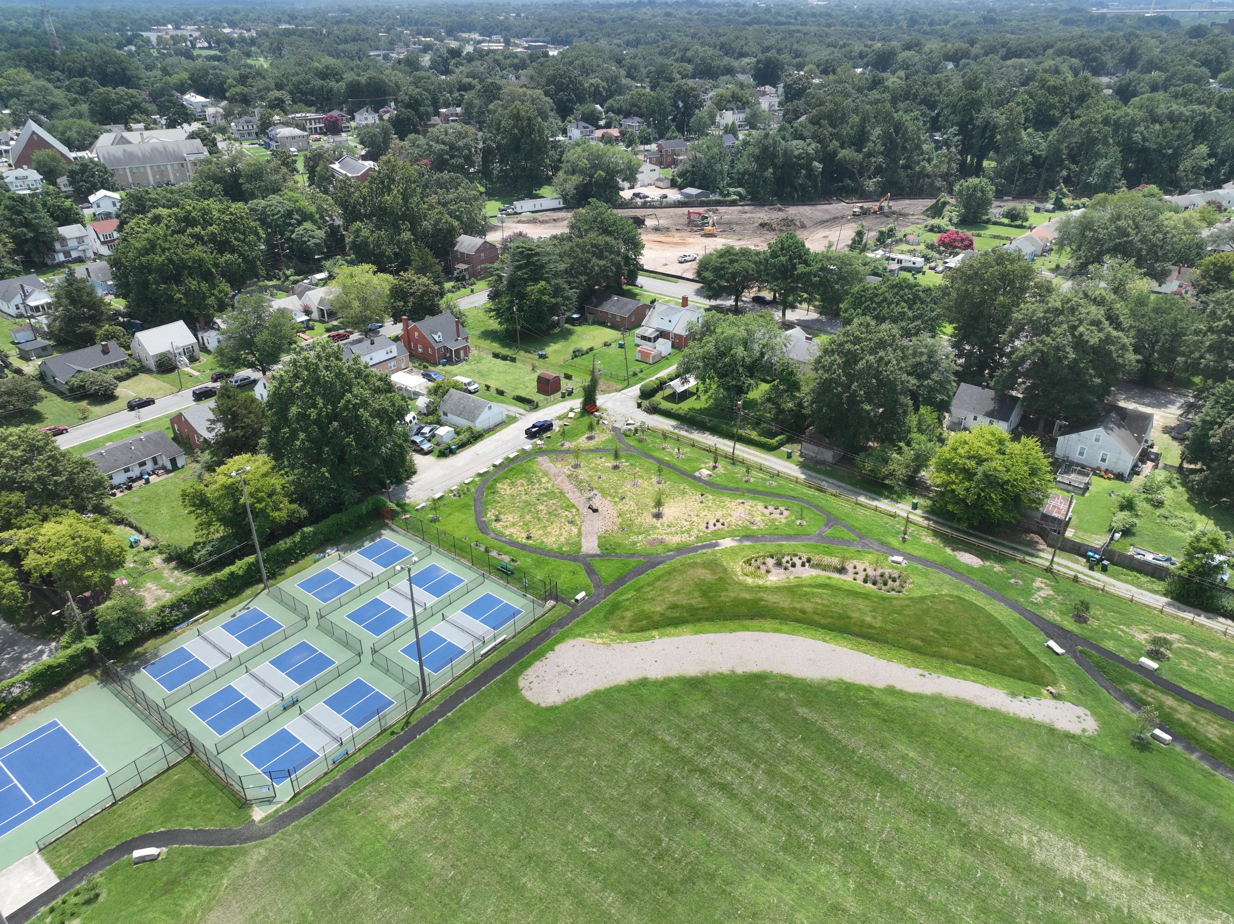
The Groundwork Network plants micro forests (densely planted assemblages of native trees and shrubs that fit into roughly four parking spaces) designed for the gaps that larger infrastructure misses. But the effectiveness of their intervention can also be difficult to prove.
Satellite imagery, with its coarse resolution, can't detect temperature change at the scale the size of a parking spot. Meanwhile, a more traditional in-house drone data collection program across 19 geographically distributed affiliate sites isn't scalably feasible.
What drones made possible
Groundwork began using DroneDeploy to capture thermal imagery at specific project sites, timing flights before and after green infrastructure installations to document surface temperature change. The results were striking enough to change how they make the case to funders and policymakers.
Their micro forests, only a few years old, are already cooler than the mature single street trees planted nearby. Compared to the adjacent asphalt, they register over 50 degrees cooler.
That single data point, visible in high-resolution thermal maps that funders and community members can actually look at, gives the advocacy something it didn't have before: hard evidence to point to.
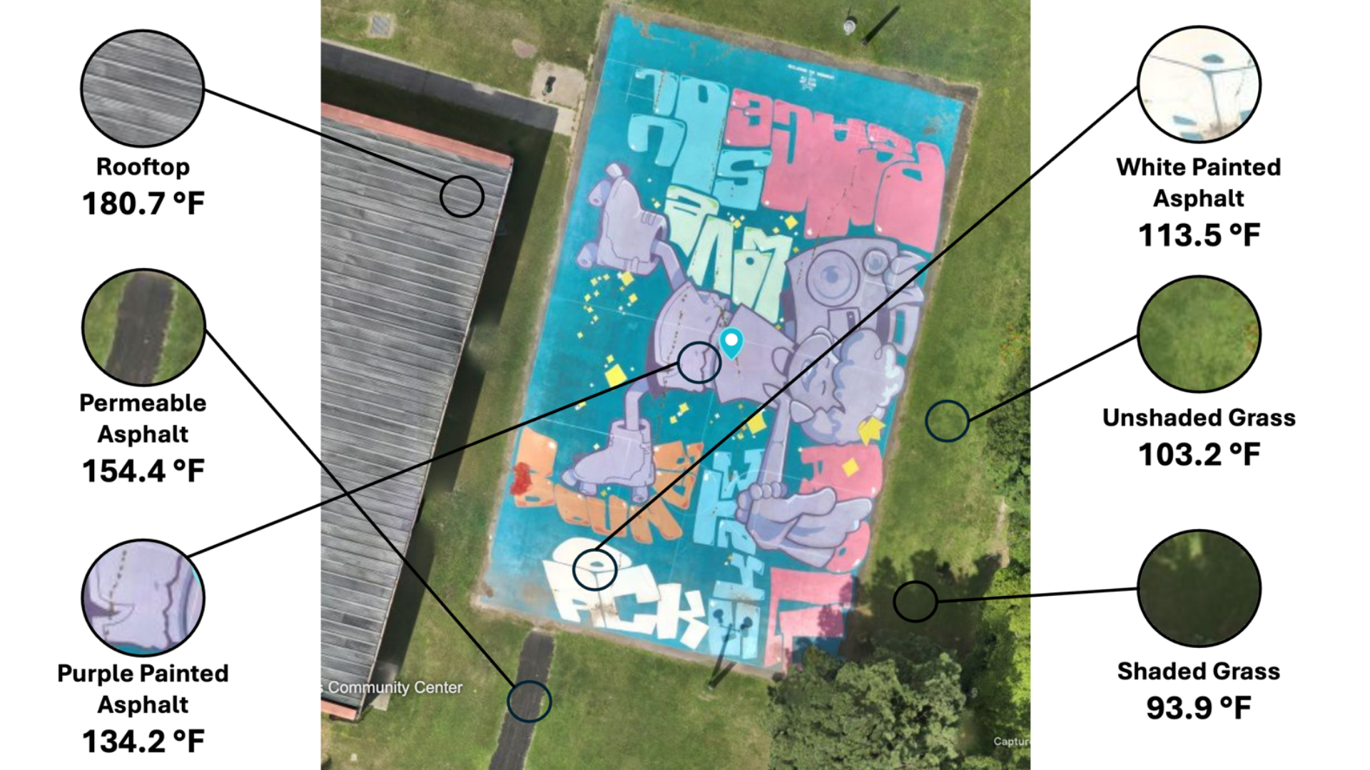
In New Orleans, thermal imagery of the park under the I-10 overpass now appears in Groundwork's impact reports and public communications. In Richmond, Virginia, Hoffman and his team flew over a park that converted an old basketball court into a roller skating rink, documenting how different surface materials produce measurably different temperature profiles: white painted asphalt, permeable pavement, and mature shade trees each register differently.
.png)
The platform's flexibility across geographically dispersed sites mattered as much as the data quality. Because Groundwork operates as a distributed network, Hoffman needed a tool that affiliates could use locally without requiring centralized expertise.
"Site-by-site project management" and the ability to request flights at the local level meant that when a heat wave was coming, an affiliate could document conditions before and after a project installation, without waiting for a team to fly in from headquarters.
“Using DroneDeploy and the thermal capabilities of these drones, we've been able to show that our micro forests, which are only a few years old, are cooler than the mature single street trees nearby and over 50 degrees cooler than nearby asphalt.”
— Dr. Jeremy Hoffman, Groundwork USA
The evidence that moves cities
The thermal data Groundwork captures shows up well beyond internal reporting. Funders and City agencies both draw on it when making decisions about where to invest in the near-term.
The before-and-after imagery of the New Orleans park was featured in a foundation video promoting the space.
That feedback loop of intervention, documentation, public communication, and investment is what Hoffman is trying to systematize across the entire Groundwork network. Every affiliate making the case for green infrastructure in their city needs the same evidence base.
The more sites they can document, the stronger the argument becomes that small, targeted investments in nature produce real, measurable results.
“One of the other really great things that we can do with this is pairing both the visual imagery with the thermal imagery to tell the story of innovative park spaces in the Groundwork Network”
— Dr. Jeremy Hoffman, Groundwork USA
Looking ahead
The next chapter of that work involves a different kind of investment: in people.
Groundwork's youth programs have engaged more than 1,000 young people across its affiliate cities over the last few years, connecting them to what Hoffman calls "the green jobs of the future." In Richmond, several of Groundwork RVA's youth green team members were on-site the day Hoffman flew the park survey, watching the thermal drone document the space they helped steward and study with ground-based thermal cameras.
Hoffman wants to go further. He's actively seeking funding to launch a youth-focused UAV training program within the Groundwork network: hands-on drone skills, paired with the conservation science they'd use them for.
"It's been really awesome to have both the ability to show these green spaces from above, and to inspire the youth and our green teams to see drone technology as a viable way to track and monitor these spaces as they change over time," he says.
The technology that proves the value of green infrastructure could also train the generation that builds it.
DroneDeploy will continue supporting Groundwork's work in 2026 and beyond through its nonprofit and training initiatives. If you're interested in bringing this kind of program to your community, visit dronedeploy.com/about/dot-org.
“Groundwork's youth program engages hundreds of youth across these cities nationwide every year in learning about the green jobs of the future. It's awesome to have both the ability to show these green spaces from above as well as inspire the youth and our green teams to see drone technology as a viable way to track and monitor these spaces as they change over time.”
— Dr. Jeremy Hoffman, Groundwork USA
Interested in learning more or connecting with Groundwork USA? You can follow his work on LinkedIn.
.png)
FAQ
Related articles
Ready to learn more?
Contact sales to see how DroneDeploy can give your teams the power to document and analyze your sites from the air and ground – all in one AI-powered platform.