Mapping a Plan for Clean Water: How Water for Good Uses Aerial Imagery
.svg)

Quick Summary
Water for Good is using DroneDeploy to transform access to clean water in the Central African Republic, a country where less than 30% of the population has reliable water. By mapping terrain and capturing elevation data with drones, the nonprofit can remotely plan and build solar-powered water distribution systems tailored to each village’s needs – cutting field survey time by over 80 days annually. This precision helps place water points where they’re most accessible and ensures long-term community support and maintenance. Already the country's largest water provider, Water for Good is scaling efforts to reach one million people with over 1,300 new water points.
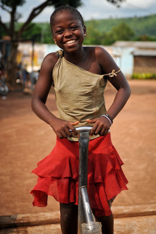
The Central African Republic is one of the poorest and most fragile countries in the world. Despite adequate environmental resources, the country faces cycles of violence and political instability that have left the majority of the five million people living there without basic needs such as clean drinking water. Currently, conservative estimates state that just under 30% of the country has access to reliable water sources, resulting in two major consequences.
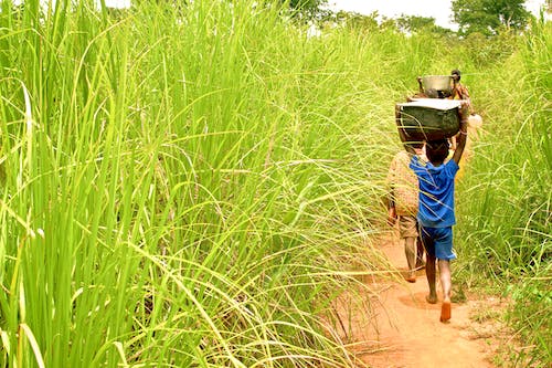
Without reliable ground water, shallow hand-dug wells and surface water can easily become contaminated, and often lead to the spread of waterborne illness. These illnesses directly contribute to the Central African Republic having one of the world's lowest life expectancies, at just 52 years old. The lack of easy access to the water also means women and children spend hours every day hauling heavy loads back to their families. As a typical 5 gallon jug weighs over 40 pounds, with most families using multiple jugs every day, this additional workload reduces overall quality of life, and makes it harder for children to attend school, and for women to maintain their households.
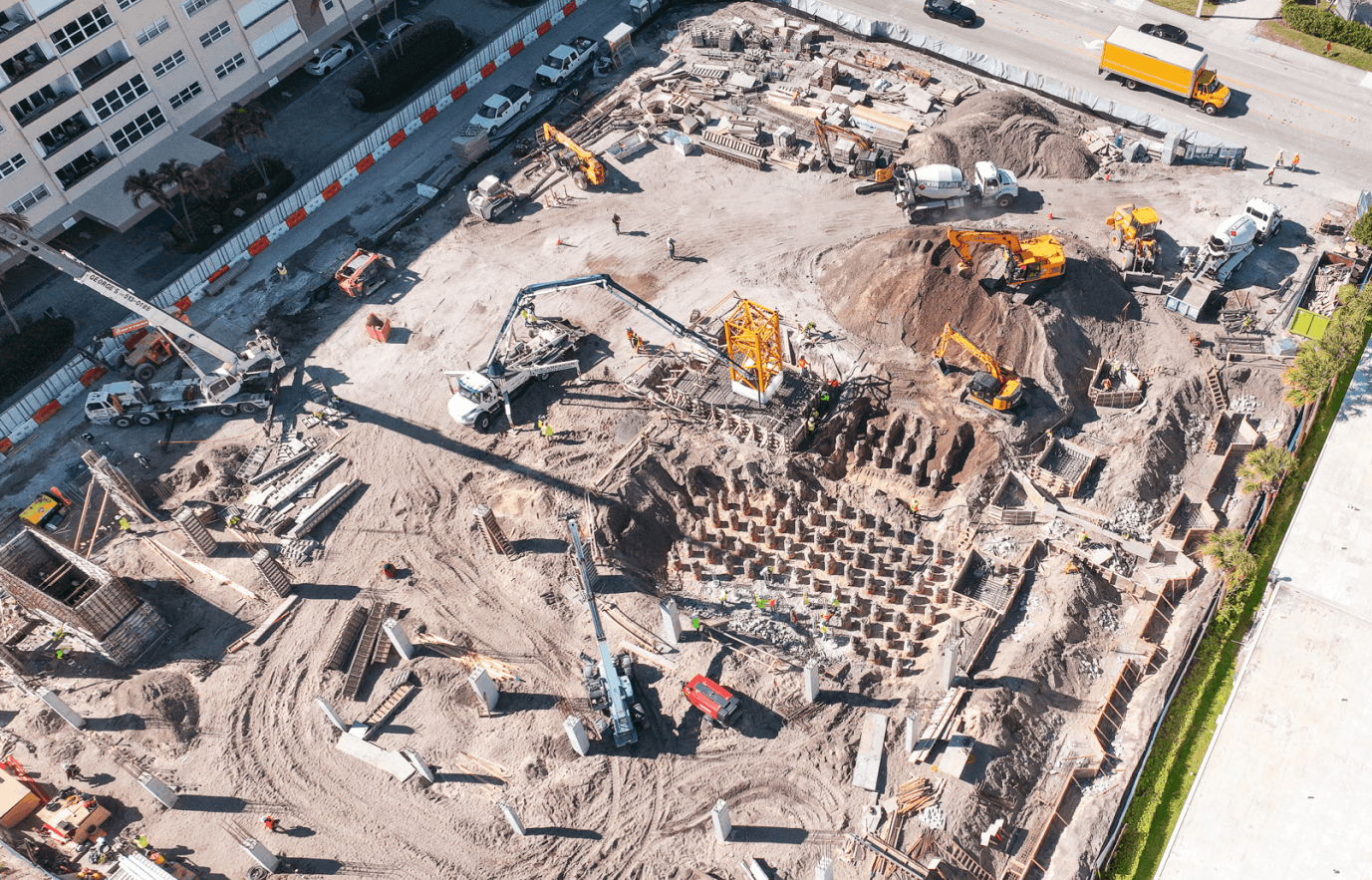
To combat these challenges, Water for Good, a nonprofit organization, hopes to provide a lasting, sustainable service of water to the region. To do so, the group is utilizing photogrammetry techniques and DroneDeploy maps to understand the terrain around them, before drilling wells and constructing water pipelines. As of this writing, the organization has already become the largest water provider in the Central African Republic.
Surveying Terrain for Pipeline Construction
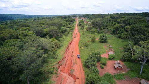
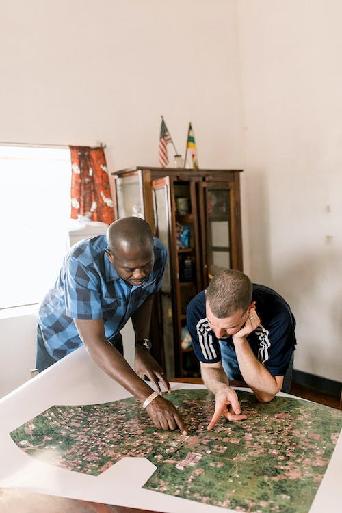
The organization’s Director of Operations, Jay Hocking, continuously juggles numerous logistical challenges. “It’s a difficult country to work in,” Jay said, “the region that Water for Good focuses on is about the size of the state of South Carolina, and there is only one paved road.” Obviously, this means that travel to and from different sites can be very difficult. As the nonprofit tries to be as efficient as possible, this means careful planning to reduce unnecessary travel and further elimination of multiple site changes. DroneDeploy’s orthomosaic maps and 3D models have significantly aided these processes, by providing a remote planning system and quick distance estimations for Water for Good’s teams.
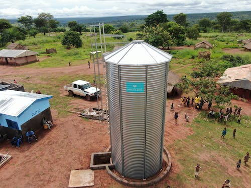
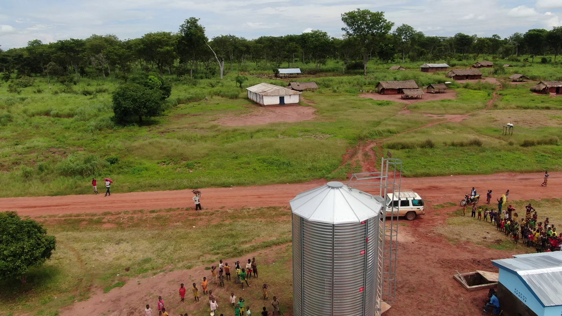
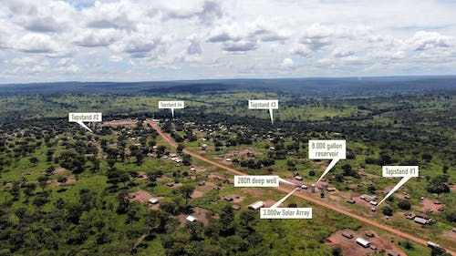
Another use case? Identifying where to position as-designed reservoirs and pipes for optimal use by all residents in a given region. As Water for Good’s mission is to provide clean water to remote communities, their goal is to design and implement multiple solar-powered pipe distribution systems for use by anywhere from 1,500-4,000 individuals, providing 3-8 community water access points distributed across a village. “Ground-based surveying does not allow us to clearly position community water points where they'll be most needed, as we can't easily verify distances to the water points for all community members. Using DroneDeploy, we can design a better overall plan,” Jay stated.
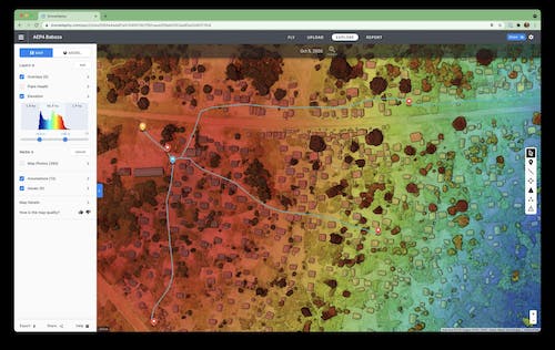
Understanding Elevation & Population Data
Elevation data is necessary to understand the pressure and precise locations that gravity-fed water pumps can deliver water to. Using DroneDeploy, Jay and his team are able to rapidly gather both aerial imagery and elevation data of the given area for service, allowing them to plan out a pipe distribution system without having to drive back and forth for additional surveys. Jay estimates that by using DroneDeploy for these services, the nonprofit has saved over 80 days worth of field time each year. The team uses the annotation toolbox frequently as well. “We can now make adjustments on the fly knowing that we can verify the elevation data later for any point on the map, without having to drive back to the community to do another survey,” Jay explained.
Another clear advantage to having up-to-date imagery of a given community is the immediate boost in accuracy in placing each community water point, Jay told us. Without census data, nor quality satellite imagery, it's difficult to determine where each water point should be placed, in order to maximize the ease of access for each household. For example, in the town of Nandobo, Water for Good had implemented a dozen manual pumps, but was ready to upgrade the town to a larger solar powered piped distribution system in 2020. Using DroneDeploy, they were able to use current imagery of every neighborhood, to see exactly where each manual pump was located, where new water points should be installed, and how far each household would have to walk to access those water points.
This ability to plan for the proper community needs through adequate data and understanding means more people are able to get access to safe, reliable drinking water.”

Jay Hocking, Chief of Operations, Water for Good
The Road Ahead: Projects Built to Last
Focused planning is what creates projects built to last. Water for Good told us that although many water projects have been built across Sub-Saharan Africa, due to poor planning and a lack of community support, as much as 60% of the installed projects have failed in the region. In contrast, by focusing on implementing water points not just where they're technically possible, but where they'll provide the highest benefit to their communities, Water for Good has been able to get buy-in from the people living in these areas themselves - a tool critical for long-term maintenance.
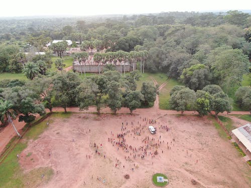
For general upkeep, Water for Good's locally trained technicians make regular visits to the water points in the country, collecting community payments for services, fixing problems, and servicing worn parts. As a result of the more than 20,000 service visits by these teams, Water for Good is able to achieve over 95% functionality for the water points in these communities. Their current strategy includes designing every single water point needed for an entire region, with full implementation aided by drone mapping. The nonprofit’s current focus region is home to about one million people - with 1,325 new water points already in the planning stages to take the area from 10% water access up to 75%. Already in 2021, 39 new piped water points and 22 manual pumps have been installed - which means over 25,000 people have gained water access this year alone. We’re looking forward to continuing to support Water for Good through our Drones for Good program.
If you’re interested in learning more about Drones for Good, visit our website, or contact us.
.png)
FAQ
.png)
Ready to manage your data from the very start?
Book a quick call to see how DroneDeploy streamlines capture from construction through building ROI.