Reality capture ROI in data center construction — lessons from a former head of global controls
.svg)
Quick Summary
Matt Craske ran global controls across one of the biggest, most complex data center portfolios out there, and in DroneDeploy's May 21 webinar he did the thing most reality capture conversations skip and talked real money. Site due diligence that normally costs $50,000 to $100,000 came in closer to $10,000, utility strikes dropped to almost nothing once the team trusted its underground as-builts and project controls teams ran 35 to 40 percent leaner without touching a single KPI. What held it all together was his bigger argument that construction will never keep pace with the tech industry, so the real goal is predictability, and predictability lives or dies on whether you can trust your field data.
On May 21, 2026, DroneDeploy hosted a webinar about how data center teams deliver on time using visual data they can actually trust. The featured guest was Matt Craske, a former head of global controls, and few people have managed a data center portfolio more geographically diverse or more complex than the one he ran.
Most conversations about reality capture stay high-level, talking about superpowers and digital records and remote visibility before stopping short of the part operators actually care about. This conversation went further, because partway through, Matt stopped speaking in concepts and started putting real numbers on the table.
That stretch of the conversation is the reason to read this recap, which walks through the ROI of reality capture for data center construction phase by phase, in the terms Matt used to describe it.
Why data center construction is uniquely high-stakes
Data center economics work differently from most construction. Space and power sell before the building is finished, so every week of delay turns directly into lost revenue or a customer who walks away. That pressure sits on top of a harder structural truth, which is that the tech industry moves faster than construction ever will, and that gap is not closing.
Matt's framing was direct. Because construction will never outrun the demands of the tech business, the next best thing a team can be is highly predictable. A team that can say with confidence when a site will finish, and then actually hit that date, removes most of the tension between the two worlds.
All of that predictability depends on having data you can trust. A schedule is only as good as the field information behind it, and field information is exactly where most portfolios carry hidden bias and blind spots. That is the problem reality capture solves, and it is the lens you should read every ROI figure below through, because none of the numbers mean anything if the underlying record cannot be trusted.
Site selection and due diligence
Site selection runs on a hard constraint, because a company might evaluate ten or twenty candidate sites for a single capacity problem and cannot afford to spend heavily on diligence for every one. Traditional topographic surveys make that constraint worse, since they are slow and, depending on how much travel is involved, they run anywhere from $50,000 to $100,000 per site.
Reality capture changes the math on both counts. Matt put the equivalent cost at roughly $10,000, and the cycle time is faster as well. The output is also more useful than a traditional survey, because instead of a text-based diligence report, decision-makers get a read they can see for themselves:
- High-resolution imagery shows the full site in detail.
- Video flyovers give context that a table of numbers never could.
- 3D visualization lets the team explore a site without ever traveling to it.
That kind of read matters more than it might sound. Matt described an executive on his team who refused to believe there was a nearly 50-foot drop-off on one of their candidate sites until the reality capture data showed it plainly. The figures in a report had not convinced him, but seeing the drop-off for himself ended the debate.
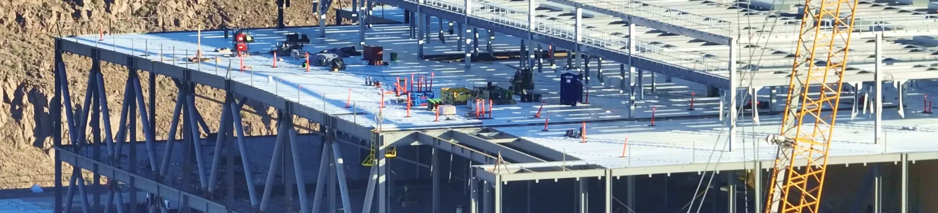
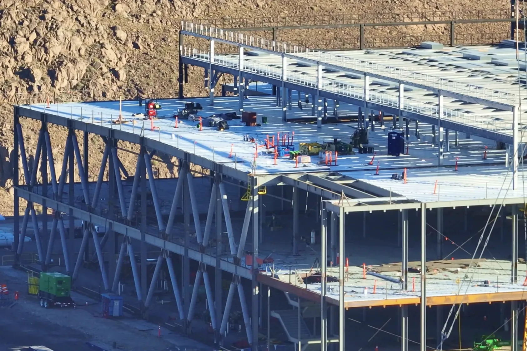
Civil, earthworks and underground as-builts
The ROI in this phase comes from avoidance rather than savings. Matt was blunt about the value of underground as-builts, explaining that their real worth is measured in every utility strike you do not have. On his previous portfolio, strikes were a recurring problem, and each one created trouble on three fronts:
- Every strike put the crew at safety risk.
- Every strike delayed the schedule while crews repaired the damage.
- Every strike carried the risk of taking an operating data center offline.
After the team moved to digital dig boards and reality capture-based as-built verification, those strikes dropped nearly to zero. Matt did not share a specific dollar figure, but he was clear that the reduction was dramatic. Accurate underground records also pay forward over time, because the next project on the same site inherits them.
Mass grading is the other major lever before vertical work begins. A grading campaign can run six to nine months, and someone has to keep eyes on it the entire time. Reality capture makes that oversight remote, which removes the need to mobilize a full site office just for monitoring. As a result, owners can manage grading contractors directly without a GC or CM in the middle, or they can pass those savings straight back to the client.
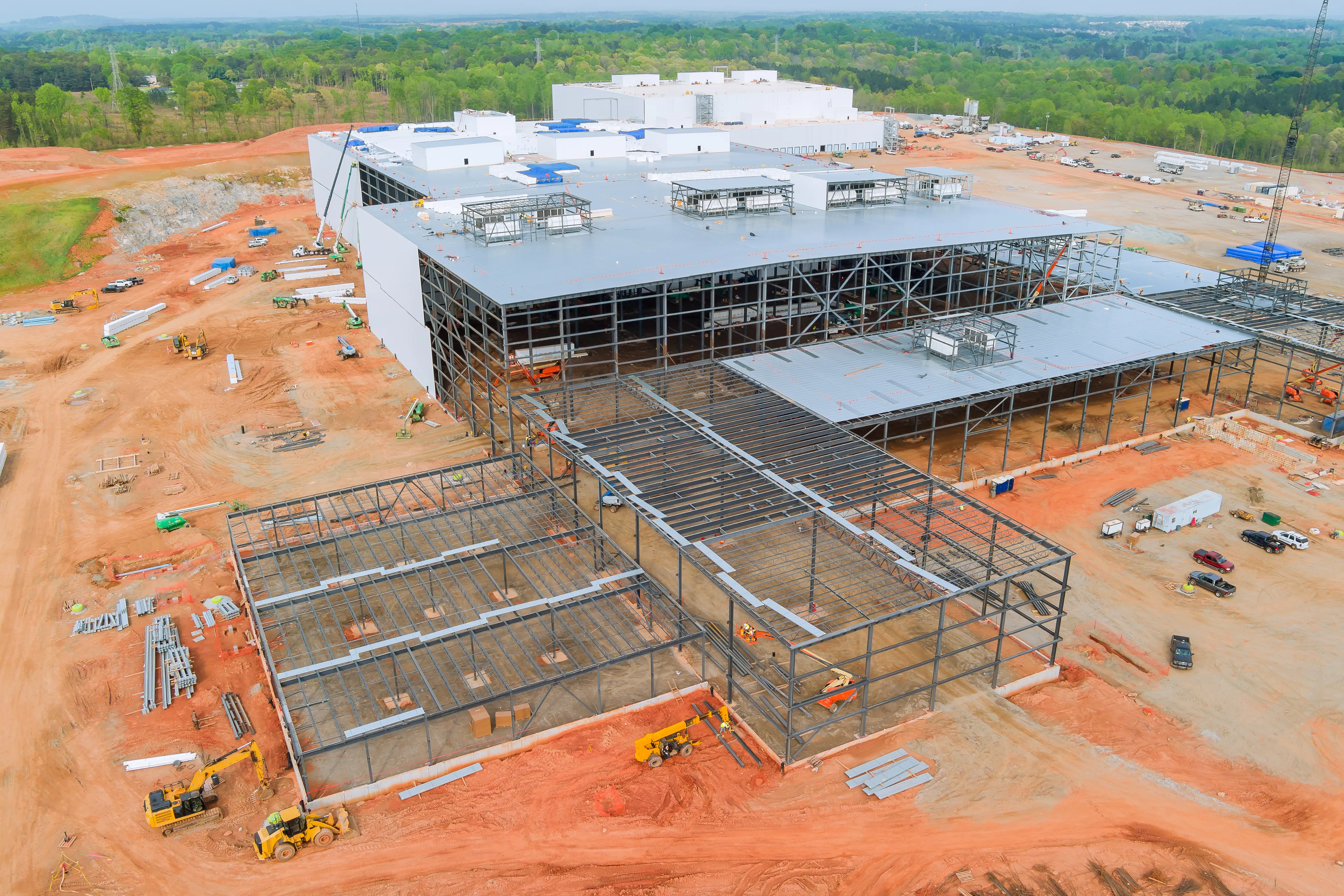
Superstructure, fit-out and a budget hiding in plain sight
The most surprising finding in the webinar came from the budget itself. On Matt's previous portfolio, some projects spent up to $150,000 on rich media, meaning the professional video crews and polished footage that fill executive presentations. His observation was that this figure runs to about 50% of what an entire reality capture program costs.
That comparison reframes the whole budget question. The money already exists on most large projects, and it is simply pointed at something that looks impressive but delivers little beyond the meeting it was made for. Redirecting it funds the reality capture program while producing documentation the whole team can actually use.
The capture itself earns its keep once work moves inside the building. Time-stamped interior records show what sits behind walls and above ceilings before crews close them up, and they preserve the full history of how the structure came together. That record becomes the foundation for progress tracking today and for rework avoidance later, when someone needs to know exactly what is behind a given surface.
Operations handover and the 30-year tail
Operations is where the long tail of all this data finally shows up. Matt was direct about the reason, pointing out that operations teams live with these assets for 30 years after handover. The visual record of how the building came together becomes genuinely useful the moment something goes wrong in year five or year ten, because what sits underground, what runs through the walls and how the site changed over time all turn into answers when a problem appears.
Matt also pushed on the definition of the as-built itself. Rather than fighting to keep a BIM model perfectly current, he argued for a layered handover, where system definitions and spatial data live in the BIM model while geospatial and visual history live in reality capture. Handled that way, operations gets exactly what it needs for each kind of question without the overhead of one model trying to do everything.
The project controls efficiency number
This number came out of a question during the Q&A, and it is the one most worth writing down. Matt broke down how a project controls team actually spends its time across three rough buckets:
- About 50% of the time goes to generating the data the team needs to analyze.
- About 30% goes to manipulating that data into something useful.
- Only about 20% is left for actually acting on it.
Visualization from reality capture goes straight at that first 50%. By Matt's math, it cuts the data-generation load by roughly half, which is a 25% efficiency gain on its own. Adding automated measurements and progress tracking takes another 15% off the rest, and the total lands at a 35% to 40% efficiency improvement for a project controls team without changing a single KPI.
That figure is the through line back to where the conversation started. Predictability at scale is not an aspiration a team can talk its way into, because it comes from giving the people who track cost, schedule and scope a faster and more trustworthy read on reality, so they can spend their hours acting on data instead of chasing it.
Where to start
Matt closed with practical advice for anyone standing up a program. He suggested starting with a clear goal that goes beyond simply having a drone on site, which means knowing what you want captured and making it a requirement. The programs that work best are tied to a real objective, such as managing more cost of work remotely or getting your best people onto more projects. The ones that fail tend to set an impossible bar before taking a single step, holding out for full automation before they will capture anything at all. The better approach is to start manually if that is what it takes, as long as you start somewhere.
The full conversation goes deeper on every phase above, from accuracy specs to AI-assisted progress tracking. Watch the full session or download the DroneDeploy Data Center Playbook to go deeper.
.png)
FAQ
Related articles
.jpg)
Ready to manage your data from the very start?
Book a quick call to see how DroneDeploy streamlines capture from construction through building ROI.