July 2025 Product Release
.svg)
Quick Summary
DroneDeploy’s July release enhances aerial and ground workflows with Snapshot for instant visual sharing, smarter inspection automation, and more accurate, customizable Safety AI – built to cut delays, boost jobsite safety, and streamline collaboration.
The July release puts clarity and speed at the core of every workflow—starting with Snapshot, a powerful new way to grab and share clean, in-context visuals from any map in a single click. Alongside it, we’re rolling out smarter flight planning for repeat inspections, dock thermal flight planning, dock geofencing visibility, and major upgrades to DroneDeploy Ground and Safety AI.
Whether you're flying drones or walking sites with 360 cameras, these updates are built to help your teams move faster, collaborate better, and capture exactly what matters.
- Snapshot - Quickly grab a clean, savable view of exactly what you’re seeing in DroneDeploy—including overlays. Annotate directly on the Snapshot for better communication and collaboration.
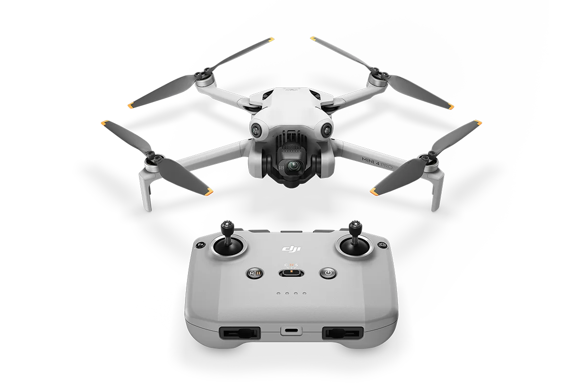
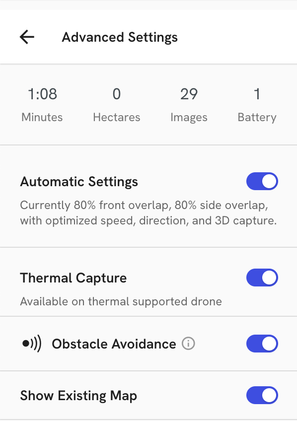
- DJI Mini 4 Pro Flight Support - Beta - Flight support for the DJI Mini 4 Pro, an affordable, sub-250g drone, is now in Beta.
- 2D Orbit Flight Plan - Inspect assets or points of interest in a simple, repeatable way by selecting a point on the map and capturing photos in a circle around that point.
- View Geofencing on Dock Flight Plan - During flight planning, imported geofences can be viewed on the base map.
- Dock Thermal Flight Plans - Customers using thermal docked drones with map plans can have the same easy flight planning experience as RGB only drones.
- Safety AI Custom Safety Referencing - Safety AI is no longer limited to US Fed OSHA standards and now has the capability to search for safety risks on local, regional, or company specific standards.
- Safety AI Risk Filtering by Project in LLM - Users can now filter the types of safety risks that are detected by Safety AI, helping to reduce the noisiness of risks they do not want to be notified of.
- Process Safety AI on 360 Panos and Send Report - Safety customers who prefer to capture 360 panos over 360 walkthroughs can have panos processed for safety risks giving them the ability to now utilize Safety AI in their preferred workflow.
- Walk Visualization Improvements - Walk navigation is now simpler with the addition of a walk ribbon and user defined navigation settings.
- Smart Uploader Improvements for Ground - Using Smart Uploader in DroneDeploy Ground is simpler with the addition of the ability to Move Media to the precise location prior to upload and identifying Start and End Point of walks for proper placement and orientation during processing.
For a list of all features launched as part of the July release, check out the release notes.
DroneDeploy Aerial
Snapshot
Fast, clean, in-context visuals for fast-moving teams.
Feature Benefits
- Screenshot any map or model: rotated, elevation/contours, marked up, with overlays.
- Copy straight to clipboard for use in emails, Teams, Procore, ACC, etc.
- Add text or draw for context and specific detail.
DJI Mini 4 Pro Flight Support - Beta
DroneDeploy flight support for the DJI Mini 4 Pro is now in beta. More info available here. The Mini 4 Pro is an affordable, lightweight drone for Android devices.
Feature Benefits:
- Flies up to 45 minutes with the Intelligent Flight Battery Plus.
- Weighs under 250g, making it ideal for EU and remote ID-exempt operations.
- Capture maps, photos and video.
- Priced from $759 USD, making it a great choice for budget-conscious programs.
2D Orbit Flight Plan
Simplify repeat inspections and track changes over time with consistent photo capture.
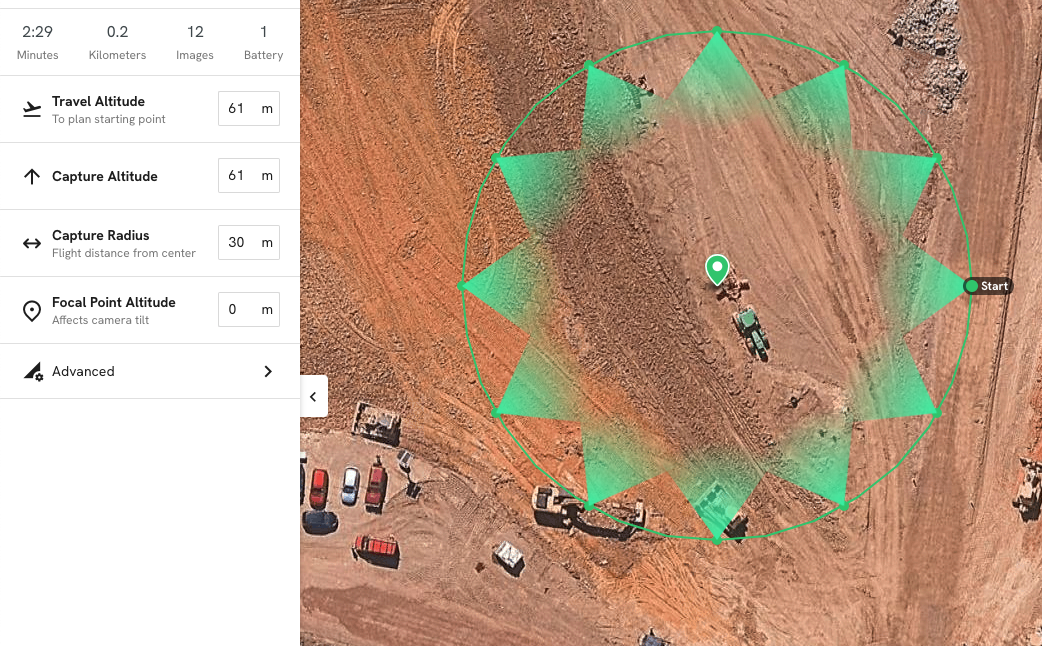
Feature Benefits
- Select a POI, set your radius/altitude—fly and repeat
- Auto-calculated gimbal angles reduce operator error and setup time.
- Photograph from the same position each time for easy side-by-side comparisons.
- Use with a dock for efficient inspection automation.
View Geofencing on Dock Flight Plan
View Geofencing adds visual overlays of imported geofenced areas to the flight planning base map, helping teams avoid mistakes and stay within safe operating zones during mission setup.
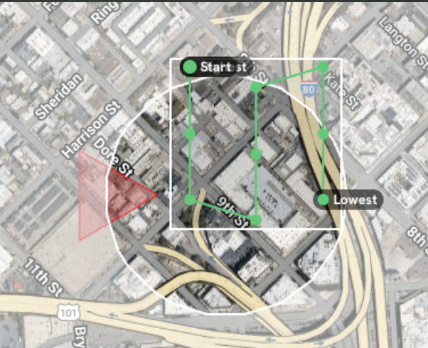
Feature Benefits
- See operating boundaries (white) and no-fly zones (red) directly on the map while planning.
- Avoid wasted time creating flight plans that would be blocked by dock-level restrictions.
- Supports safer, more compliant dock operations—especially for complex sites.
Dock Thermal Flight Planning
Thermal capture at scale—fully automated with a docked drone.
Feature Benefits
- The same mapping workflows you already use.
- No manual lens switching, no camera reconfiguration, no extra steps.
- Scale thermal data capture for inspection, compliance, or O&M.
- Automate capture, upload and processing into a thermal map in DroneDeploy.
DroneDeploy Ground
Safety AI Risk Filtering by Project in LLM
This feature gives customers the ability to filter the types of safety risks that are detected by Safety AI, helping to reduce the noisiness of risks they do not want to be notified of.
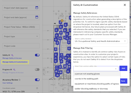
Feature Benefits:
- Users get Safety AI reports that only contain risks that are important to them
- Filtering reduces unnecessary risks to allow users to focus on resolution
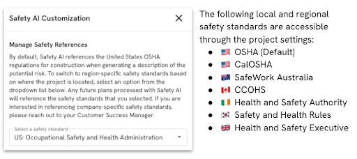
Safety AI Custom Safety Referencing
Safety AI is no longer limited to US Fed OSHA standards and now has the capability to search for safety risks on local, regional, or company specific standards.
Feature Benefits:
- Support for regional, company specific, or local safety standards is required for many projects and offers more accurate safety risk detection.
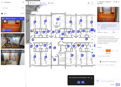
Process Safety AI on 360 Panos and Send Report
Safety AI customers who prefer to capture 360 panos over 360 walkthroughs can have panos processed for safety risks giving them the ability to now utilize Safety AI in their preferred workflow.
Feature Benefits:
- Adding support for static 360 panos in Safety AI shortens turnaround times for Safety AI reports
- Static 360 panos offer a higher resolution and image quality for customers that prefer that media type
Walk Visualization Improvements
Walk navigation is now simpler with the addition of a walk ribbon and user defined navigation settings. Opacity and thickness of the walk navigation ribbon can be adjusted to suit the user. There is also a new walk playback feature to let users see an automatic playback of their walkthrough.
Feature Benefits:
- Better adjustability to maximize the visibility of walkthroughs for an improved user experience
- Playback ability for simple visualization of a walkthrough
Smart Uploader Improvements for Ground
Using Smart Uploader in DroneDeploy Ground is simpler with the addition of the ability to Move Media to the precise location prior to upload and identifying Start and End Point of walks for proper placement and orientation during processing.
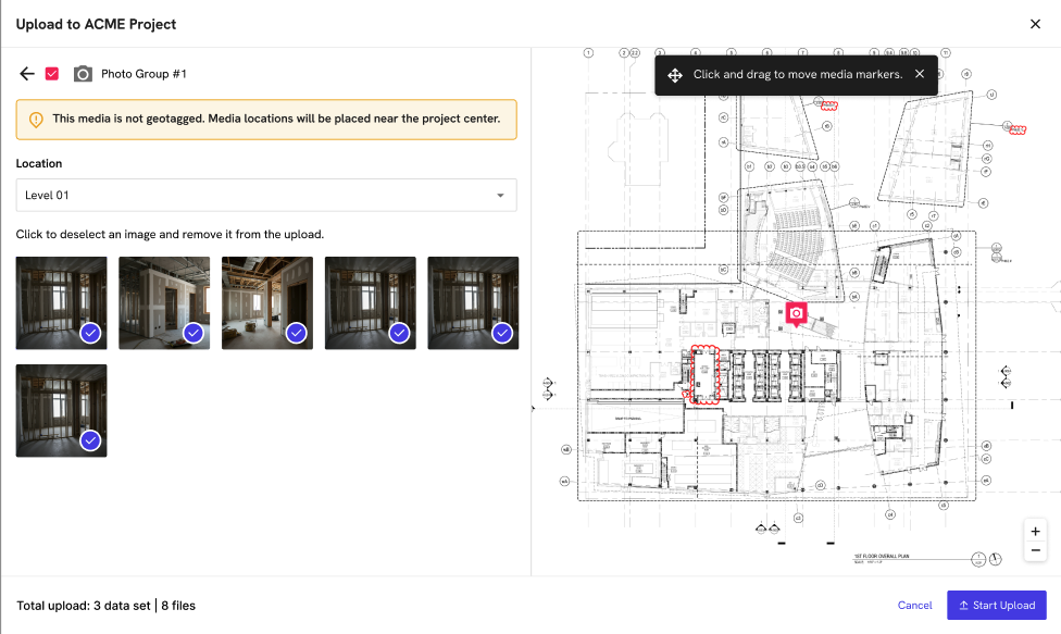
Feature Benefits:
- Pre-placement of Start and End points of the walk prior to upload ensures proper walk alignment and orientation post processing
- User placement of Media groups prior to upload will ensure that users will see them in the proper location post processing
Want to learn more about the latest updates coming to DroneDeploy? Get in touch with us!
.png)
FAQ


Ready to manage your data from the very start?
Book a quick call to see how DroneDeploy streamlines capture from construction through building ROI.