Maximum asset visibility. Minimal human operation.
.png)


.png)


.png)


.png)
.png)

.png)
%201%20(2).png)
Your assets are integrated
Your missions are automated
Your data is delivered
How industrial inspection works
Build your fleet (or let us do it for you)
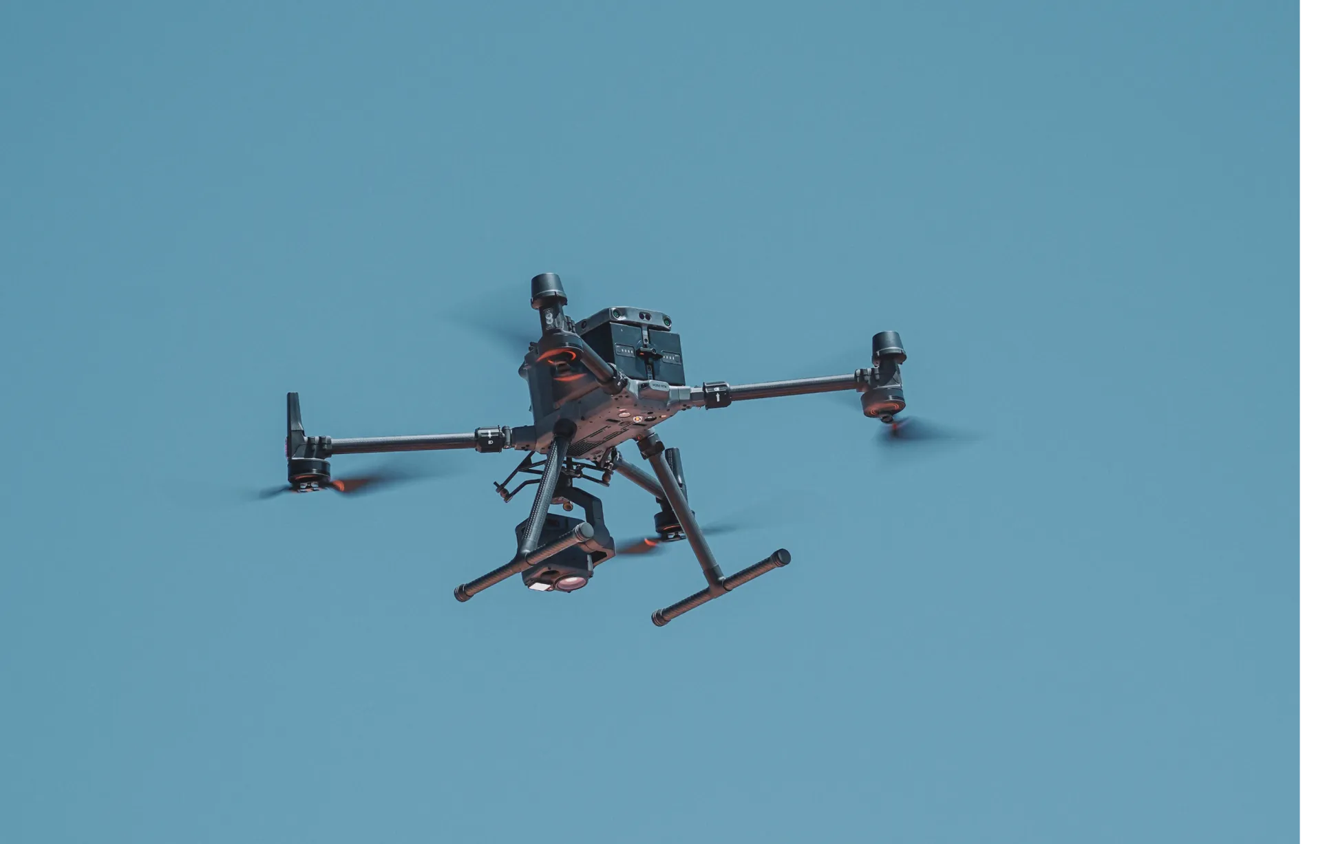
Supported hardware
Our processing engine works with data from any camera source and supports automated flights, mission planning, and execution across drones, ground robots, docked systems, and 360 cameras.
Data on demand
Need the data but don't have pilots or hardware yet?
Use our services network to capture key corridors and facilities at the cadence you need, with processed maps, photos and models delivered straight into your DroneDeploy account.
Is DroneDeploy the right fit for your operations?
Asset managers, reliability engineers, HSE managers and operations engineers managing high-value infrastructure across oil and gas, solar, mining, utilities and telecommunications use DroneDeploy Industrial Inspection to run safer, more consistent inspection programs. Program directors overseeing distributed or remote sites, and teams evaluating robotic inspection against traditional crewed methods, will find an end-to-end platform covering data capture, reporting and anomaly tracking over time.
Pipelines, storage tanks, solar panels, cell towers, transmission lines, mining equipment and offshore structures. If an asset requires regular visual inspection, DroneDeploy can automate the capture cycle.
A robot follows the same path every mission, at the same altitude and settings. In direct comparisons, DroneDeploy-powered systems collected data 30% faster than human crews. Repeat missions are identical – which matters when you're tracking change over time.
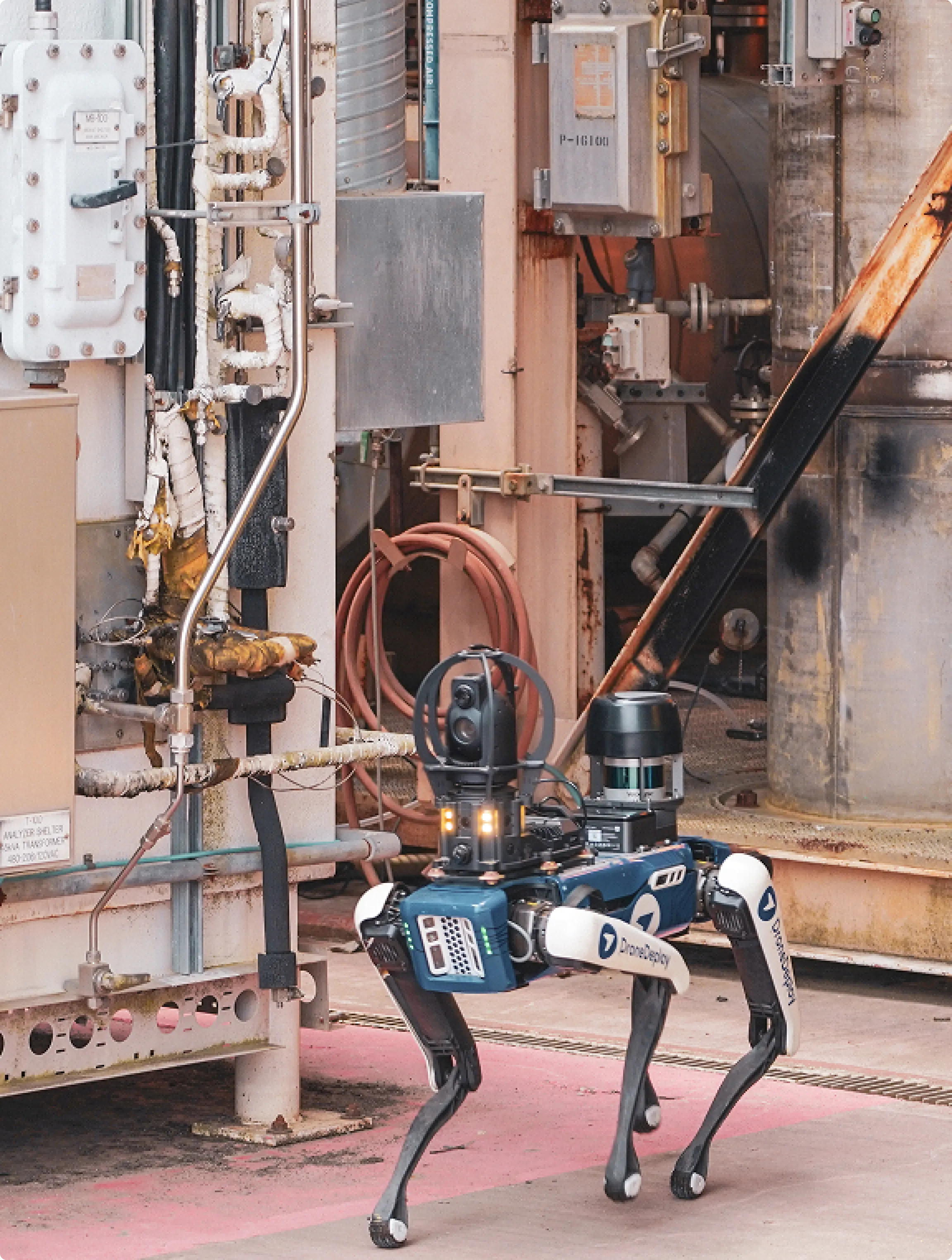
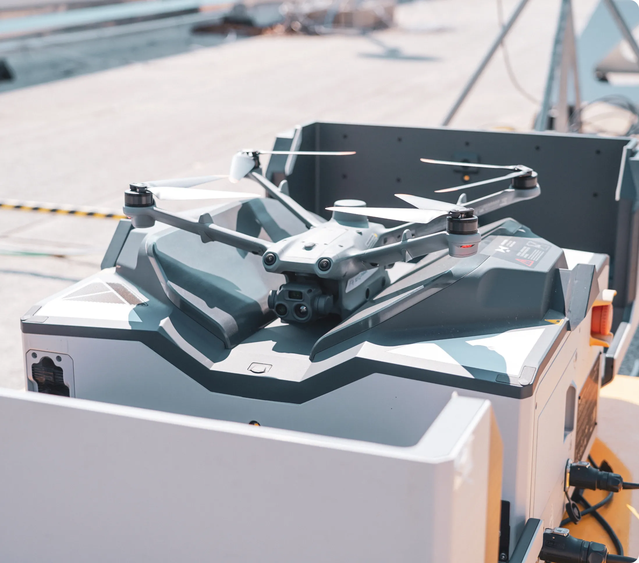
Hazardous and remote environments are where DroneDeploy Industrial Inspection is designed to operate. Robots inspect assets in environments where sending personnel creates safety exposure – flammable zones, elevated structures, active production areas, remote sites. DroneDeploy supports BVLOS operation for maximum coverage with minimum human deployment.
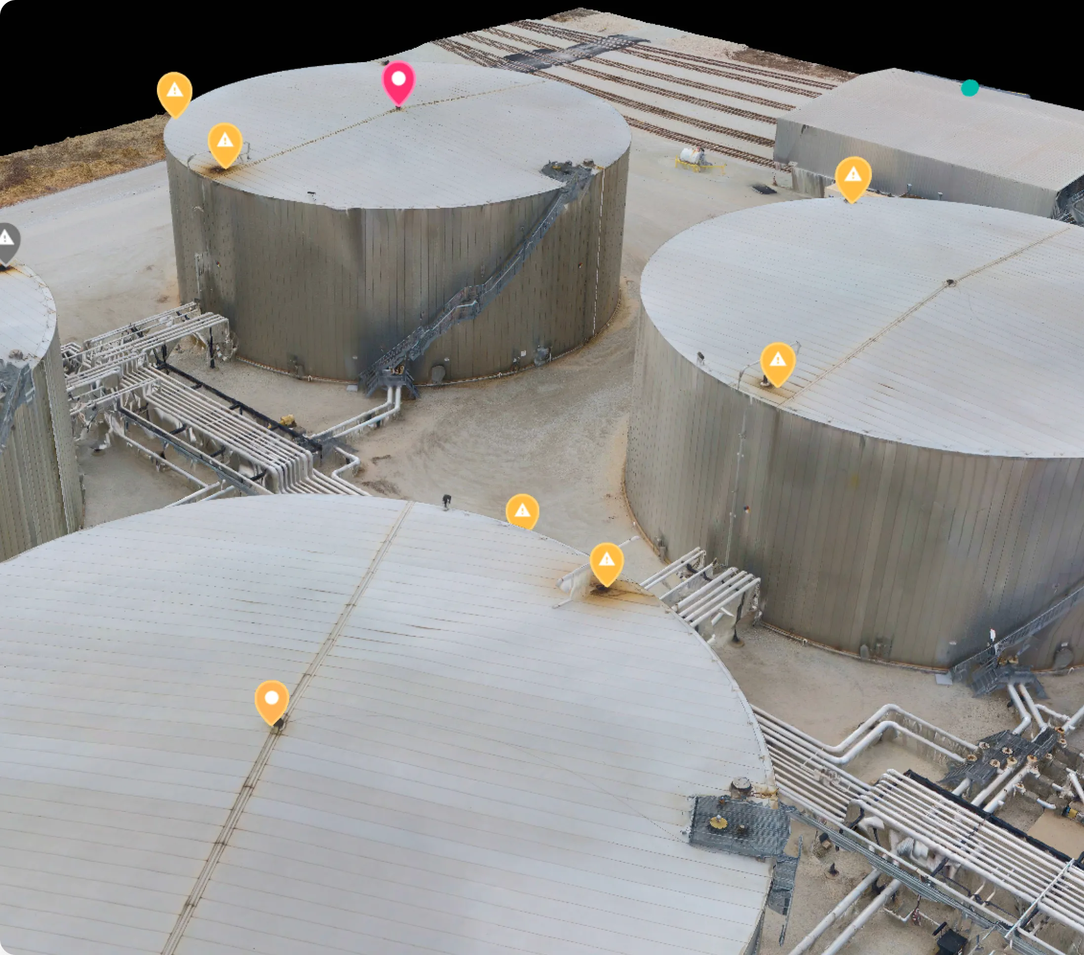
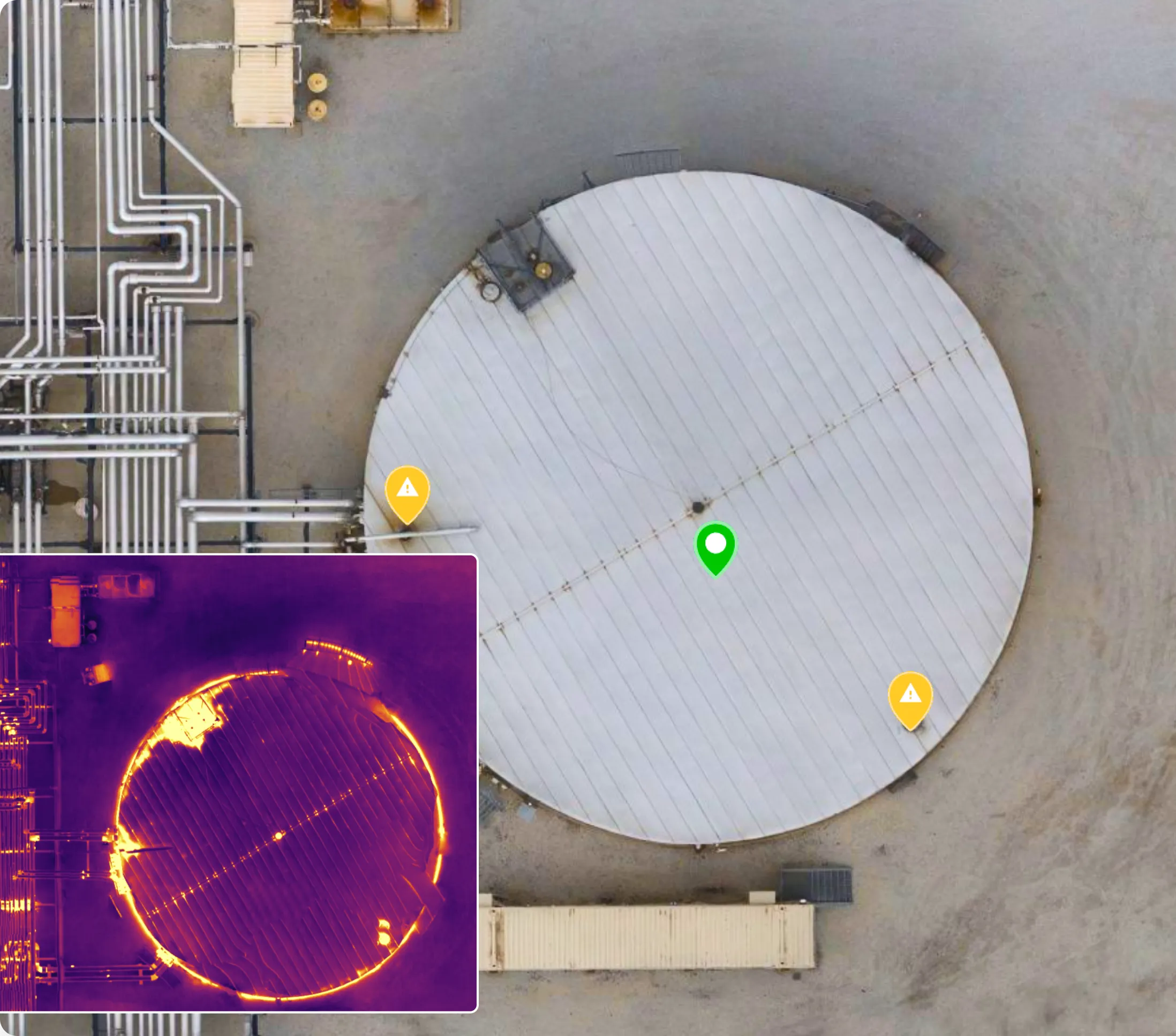
Each inspection mission builds a persistent visual record of the asset. After every capture, that record updates. Current conditions sit next to every prior inspection – sorted by date. Teams can review changes over time and identify degradation without pulling separate reports.
DroneDeploy integrates with a range of asset management and EAM systems and exports in standard formats. Custom integrations are available through the open API. See the marketplace for the full list of available connectors.
After each mission, the inspection record is organized by asset and location. Teams review captured imagery and annotate observations in the platform – each item links directly to the specific frame the robot captured. Reports can be exported and shared with the relevant stakeholders.
DroneDeploy works with a range of supported dock and robotic platforms. Check the Supported Hardware page or the Drones, Devices and Cameras section in the help center for compatibility details.
All inspection data is encrypted in transit and at rest. DroneDeploy Firewall routes data from dock hardware directly to DroneDeploy-controlled US servers – no third-party endpoints. The platform is SOC 2 and ISO 27001 certified.
Robotic inspection supports daily or continuous monitoring at a cost structure that makes monthly human inspection look expensive. More frequent capture means issues are visible earlier – before failures, not after.
Dock Automation covers construction site documentation – regular aerial capture of project progress. Industrial Inspection is built for asset condition monitoring in operational environments: pipelines, panels, towers, tanks. The focus is detecting change and preventing downtime.