Product Release Wrap-Up April 2019
.svg)

Quick Summary
- DroneDeploy rolled out a huge suite of upgrades to help teams scale drone operations — including automated 360° panoramas and video missions, expanded inventory management, smarter AI tools, and a major upgrade to Live Map HD for real-time crop scouting.
- New stockpile workflows now include Stockpile AI for one-click detection and measurement, plus richer inventory reports using Digital Terrain Models. For agriculture, Count AI automatically tallies thousands of trees or cars, while Live Map HD lets agronomists spot in-field issues in minutes.
- Mapping accuracy got faster and more powerful with Phantom 4 RTK support, improved Ground Control AI, and cloud processing for up to 10,000 images with cm-level precision. Enterprise users also gained radiometric thermal processing, revealing hidden issues in solar, O&G, insurance, and infrastructure inspections.
- Integrations were expanded with Autodesk BIM 360 and Procore for up-to-date overlays and automated progress photo syncing. DroneDeploy also announced its ISO 27001 certification and highlighted new App Market additions like real-time weather tools.
In honor of spring, the season of renewal and growth, DroneDeploy is launching a suite of capabilities to help grow your drone program across your enterprise.
We’re excited to share what we have been working on for the past few months, including updates to inventory management, Live Map HD and much more. Read on to learn about the latest flight enhancements and updates to our beta features.
Create 360° Panoramas and Videos with a Couple of Taps

It’s challenging to keep track of what’s happening on the job site and make sure that stakeholders on site and back at the office have the information they need to make decisions. Incomplete, outdated and inaccurate information contribute to delays, mistakes and cost-overruns. Imagine how much easier it would be to manage your project and keep executives and owners informed if everyone could see a visual record of your project progress!
Not only can you share maps and photos, now you can also share panoramas and videos and compare against the latest design plan revisions.

You can create an immersive experience for your home office stakeholders that really make them believe they are on site and have confidence in its progress…all without a plane trip and costly downtime. Just define your flight plan and click the button, let DroneDeploy take over in producing professional output every time.
Consistency is key when you are planning flights to capture your project. DroneDeploy’s flight templates eliminate repetitive work and create autonomous panoramic and video missions that you can re-fly again and again.
Panorama and video flight capture is available for all users using iOS devices, upload and hosting for panorama is available for Business and Enterprise customers.
Inventory Management
Track and Report the Total Quantity and Value of Materials on Site
Technology has come a long way from measuring materials with surveys, conveyors, or simply an experienced guess. With drone data, you can now measure materials more efficiently and accurately. DroneDeploy helps create stronger client relationships and less damaged or wasted inventory from over-production thanks to reliable, real-time data.

Getting data on your stockpiles’ mass, volume, and value is as simple as entering your material attributes — density, currency, and value. Using this information, DroneDeploy will not only give real-time data of your stockpiles, but will generate a report displaying the value of each material.
And now you can make more accurate measurements than ever by calculating volumes using the Digital Terrain Model to exclude conveyors and other equipment.
We have always made it simple for you to manually measure your stockpiles, and in this release we are expanding our capability to speed up this entire process with Stockpile AI, your assistant to annotate and measure stockpile volumes with a single click.
When you select the Stockpile AI icon, DroneDeploy will automatically detect and highlight all stockpiles present on your map. You can then get instant volume measurement by selecting the stockpile you wish to measure. It’s that easy.
Once the volume annotation is created, it’s still possible to customize the stockpile boundary as you usually would. Keep in mind that like our other machine learning tools, your existing annotations and corrections power Stockpile AI — which will continue to improve the more you use it.
Materials and Stockpiles Reports are available to all Business and Enterprise customers, Stockpile AI is available for Enterprise customers only.
Ready for Growing Season
Real-time Crop Scouting with Live Map HD

Live Map HD is the indispensable Agronomist’s tool. Your team can now conduct a high definition crop survey over hundreds of acres in minutes. They can identify & measure areas of concern at the field-edge, and apply instant plant-health filters help to identify drainage, irrigation, or chemical issues. Ground truthing is made simple with the iPad’s GPS for guidance.
Having data readily available in-field enables your agronomy team to make in-field assessments quickly and efficiently. Insurance claims specialists can accurately quantify crop damage and evaluate an insurance claim in minutes, helping growers to minimize lost time.
Instant Tree Counting with Count AI
Counting thousands of trees is a task that has traditionally required hours of walking in the field — Thankfully DroneDeploy’s new Count AI tool uses machine learning to make this whole process simple, with fully automatic tree counting for Almonds, Palms, and other orchard varieties. Count AI will automatically identify every tree in the areas you define, so you can rapidly quantify insured assets and estimate potential yield with high confidence.

Count AI also counts Cars and can be customized to identify all kinds of objects and anomalies in your maps.
Live Map HD is available to all paid plans. Talk to your account manager or contact sales about Count AI. Custom machine learning solutions are available.
Accurate Mapping is Faster Than Ever
Two new improvements make it faster and easier than ever to generate a highly accurate map. DroneDeploy can now process calibrated imagery from the Phantom 4 RTK drone, enabling survey-grade mapping with a 15-minute workflow. Reliable, repeatable, 2-inch accuracy without the hassle of Ground Control Points, even over large areas.
If you are using GCPs, the process of tagging the points in your images just got faster and easier. Our new Ground Control AI, trained using over 200,000 human-tagged GCPs, will automatically pinpoint GCP locations for you.
DroneDeploy’s cloud processing now supports up to 10,000 images per map, with our Large Map Processing module. Customers are already surveying huge sites for renewable energy cost & yield evaluation, and square miles of rail yards at cm-level resolution. With support for over 100 ground control and check points and distributed cloud processing, you can expect high-accuracy results in a fraction of the time you are used to from desktop processing solutions, saving you the cost of building and maintaining your own in-house photogrammetry servers.
Radiometric Thermal Processing

See the unseeable with Radiometric Thermal Flights and Processing. Whether you are working with solar, oil and gas, or insurance, Radiometric Thermal Flights detect problems that are invisible to the naked eye.
If you work with insurance, you can use Radiometric Thermal Processing to help find water ingress, roof degradation, weather damage, and low-quality installations. For Oil & gas, you will be able to see underground pipelines, identify leaks and hotspots. Even in solar you can detect string outages, faulty modules, and even sub-module defects over hundreds of acres — you can find every major problem on a 50MW solar site in a couple of days, rather than 5 months of walking the site. With DroneDeploy’s Radiometric Thermal Processing, the benefits are endless.
Radiometric Thermal Processing is available to all Enterprise Customers.
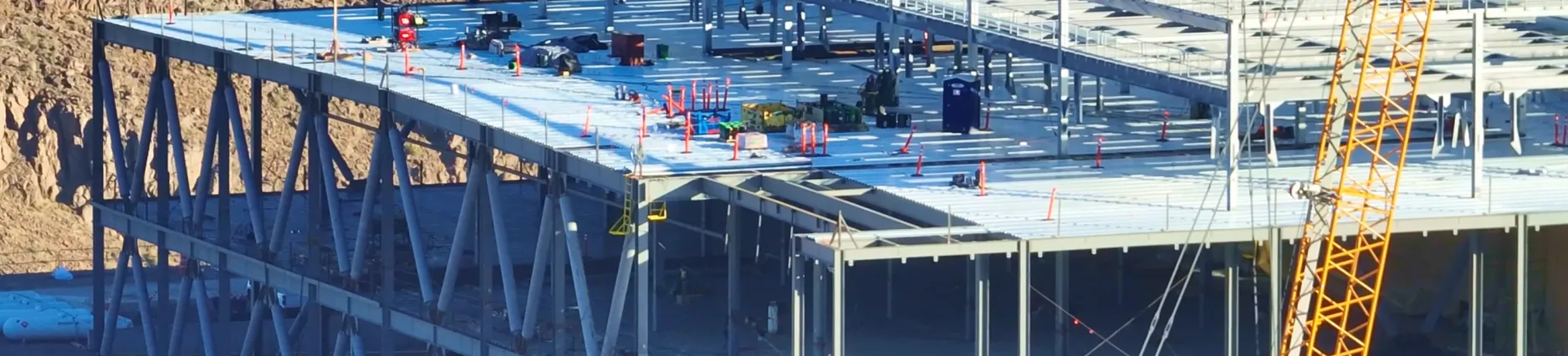
Integrations and Security
Keep Projects on Schedule with Procore and Autodesk Integrations
Is your project on track and aligned to design? With Project Overlays you can monitor your progress with ease. Whether you need to QA a post tension cable or validate as-builts, your teams can use the new Autodesk BIM 360 and Procore integrations to overlay drawings that will stay up to date with the latest revisions.
Sharing progress with your team with the latest and relevant data can be tricky. Making decisions with outdated information is a safety risk, costs money, and delays your project. Using the latest Autodesk BIM 360 and Procore integrations, you now can also automatically synchronize progress photos with your team. The project stakeholders, from management to engineers to owners, can all access the photos in the relevant Procore daily log or folder in Autodesk BIM 360.
Want to put your maps on the Autodesk BIM 360 dashboard so that everyone sees the same job site and progress? No problem — DroneDeploy has partnered with Autodesk to bring you an embedded DroneDeploy experience from right within Autodesk BIM 360.
Available on request for Enterprise Customers.
Integrate your enterprise workflow with the DroneDeploy SDK
We are proud to introduce the DroneDeploy SDK, a powerful customization and automation tool designed to boost operational efficiency. Suitable for larger enterprise-level firms as well as start-ups in sectors like energy, agriculture, and construction, the SDK platform sports four modules — UI toolkit, Datastore, Functions, and Triggers — that help automate even the most complex use cases.
It’s Official: We’re ISO 27001 Certified
We are committed to the security and protection of our customer’s data. DroneDeploy is the only cloud drone operations and data platform to have achieved the ISO 27001 certification, the international standard outlining best practices for information security management systems.
We have successfully implemented controls and procedures across our organization and our IT environments that help demonstrate our commitment to security excellence. Read about how we worked with Google to deliver the highest security commercial drone data platform on the market.
New to DroneDeploy App Market

Atmosoar
Don’t forget to check out Windsock by Atmosoar.io one of the latest additions in our App Market. Windsock brings real-time weather to DroneDeploy, for the safety of your next flight. Install it for your next flight to have current wind and weather conditions right when you need it.
Where to Learn More
- To try out the newest features, sign into DroneDeploy.
- Learn about all of our features on DroneDeploy’s Support Page.
- Watch our Product Keynotes from DroneDeploy Conference 2018 to learn more about these new features.
.png)
FAQ


Ready to manage your data from the very start?
Book a quick call to see how DroneDeploy streamlines capture from construction through building ROI.