January 2024 Product Release: Our Vision for AI and Reality Capture
.svg)

Quick Summary
DroneDeploy kicked off 2024 with major platform updates focused on AI and automation. The January release introduced the Concrete Sleeve AI Report for validating in-slab placement before pour, DJI Dock integration for fully autonomous drone missions, and Magic Annotations to auto-draw precise measurements with one click. AI Annotations now detect and quantify objects like stockpiles, trees, and solar panels, with custom models available for enterprise users. The new Locations feature helps teams organize imagery by area, making it easier to track progress over time. All updates reflect DroneDeploy’s ongoing mission: simplify complex workflows, boost field productivity, and deliver insights faster.
You might have thought that when we gave our engineering team free reign to focus on delivering over 50 improvements and enhancements this past December, we would have pumped the brakes on the impact of our January release.
Well, nothing could be further from the truth.
You see, at DroneDeploy, listening to our customers—refining and building new features is something that never stops. For each release, we are pushing and challenging our teams to deliver new ways to achieve value in our platform.
So yes, we could have coasted on the effort from December, but we instead took things up a notch. Among the many enhancements and updates in this release are new advancements in our generative AI functionality. From new reports, to streamlining and visualizing annotations, our AI game is entering a new phase and the team is excited to deliver more functionality this coming year.
Settle in and read further if you want to hear more about the stuff we are releasing this month.
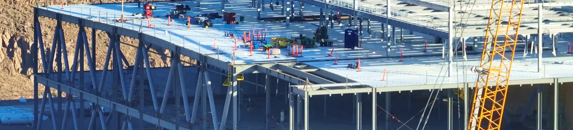
DroneDeploy Aerial
Concrete Sleeve AI Report
The Concrete Sleeve AI Report (formerly known as the Pre-Pour Concrete AI Report) is now available to Enterprise customers as an additional add-on.
These reports allow you to validate in-slab placement of sleeves comparing design to your real-world project using aerial imagery and AI to uncover and highlight deviations---before concrete is poured to mitigate the need for re-work. Once a flight* is completed, DroneDeploy will then analyze the drone ortho map against a coordinated sleeve drawing (provided by the customer prior to flight) and deliver a detailed analysis of in-slab elements within 2-4 hours.
Wilson Haworth, Senior Virtual Design and Construction Manager at Juneau Construction, has seen the impact of the report on his projects first hand.

Learn more about the Concrete Sleeve AI Report and get in touch with our team to get started.
*Specific flight parameters apply.
DJI Dock Support - Open Beta
Introducing DJI Dock support - now in beta.
Collecting data via drones has historically been limited to the availability of drone pilots on site - who are often busy with other work. A docked drone solution means humans don’t have to handle the drone for take-off, landing or file management. Docked drones will enable you and your team to fly more frequently, at a fraction of the cost per flight.
With DJI Dock support, you’ll be able to plan and execute your DJI Dock flights directly in DroneDeploy. Now, you can manage your docked drone fleet, perform autonomous inspections over large or remote areas , and have that data automatically uploaded into your DroneDeploy project, at the click of a button. The DJI Dock uses RTK between the dock and the drone, ensuring all maps captured using the DJI Dock will be high-accuracy maps, allowing you to calculate change over time and compare to design with confidence.
Whether or not you have a BVLOS waiver, docked drones can make your reality capture program more efficient by enabling more frequent flights and allowing your team to spend less time on SD cards, battery management and traveling to site.
How does it work?
- Plan your flights in DroneDeploy as normal using the standard flight types.
- Connect to any DJI Dock on your site.
- Fly the mission right from the same flight planning screen and watch a live low latency video and telemetry from the drone.
- Data captured on each flight is uploaded to the correct DroneDeploy project and processed automatically.
DroneDeploy currently supports the DJI Dock and will support the DJI Dock 2 once available in the US.
This feature is currently in beta as an add-on feature for current customers. If you have or plan to purchase a DJI Dock, reach out to your CSM to learn more.
Magic Annotations - Open Beta
Save time drawing tedious annotations by leveraging the power of AI.
DroneDeploy’s Magic Annotations can automatically select an object or distinct area with precision for area and volumetric quantification. Now, you no longer need to spend time manually creating detailed annotations around objects, like a stockpile, only to do it over again for each unique area. With one click, Magic Annotations will automatically select the entire object and generate an area and volume calculation.
This feature is a total game-changer for anyone tasked with inventory management or tracking changing stockpiles on their site.

This feature is now available in beta for Advanced, Teams, and Enterprise customers. After the beta period, Magic Annotations will become an add-on feature.
AI Annotations - Open Beta
Now you can create automatic annotations for specific objects in any DroneDeploy map using the power of AI.
The new AI Annotations feature was built to save you valuable time when annotating large volumes of data. AI Annotations leverages advanced AI models to automatically detect, annotate, and measure specific elements on your map, streamlining your workflow and getting you the answers you need, faster.
Currently, two outputs are supported for AI Annotation models: Area and Count annotations.
Area Annotations
The Area AI Annotation model will calculate the total amount of distinct area for certain objects, such as a stockpile, across your map. This is particularly useful when you need to identify and measure the area of various objects or features on your map.
Count Annotations
The Count AI Annotation model will produce a single annotation indicating the total number of detected objects. This type of annotation is helpful when you need to quickly count the occurrences of specific objects on your map.
Available models include:
- Area Annotations: Stockpiles
- Count Annotations: Trees (orchard, forest, palms), Cars, Solar Panels
Custom Models for Enterprise Customers
We understand that each Organization may have unique requirements. Therefore, we offer the option to create custom AI models for our Enterprise customers.
These custom models are trained using your organization's data and are exclusively available for your organization. To ensure the best results, it is vital to provide us with the proper data and the best description for detection during the training process.
Custom models are available for an additional cost. To request a Custom Model, contact your DroneDeploy CSM.
This feature is currently in beta and available for no additional charge to DroneDeploy Advanced, Teams, and Enterprise customers. After the beta period, Annotations AI will become an add-on feature.
DroneDeploy Platform
Locations – Open Beta
For project leaders, simply knowing where images are on a map or level is often not sufficient in order to take action.
With the thousands of images taken throughout a project, it’s hard to understand the right context for any given image. The new Locations feature unlocks the ability to categorize images in a way that makes them easy to find, and then tell the story of what happened in a particular part of the project over time. It supplies the context to make project images meaningful and useful.
DroneDeploy’s Locations feature allows users to define areas on a level or map, and the captured media is then grouped in a Location for users to easily view progress there over time. Locations also provide insights on how well each area of their project is captured, providing immediate feedback if more captures are needed.
Locations Automated Setup
If you are interested in joining the Open Beta and/or learning about the automated setup, please reach out to your Customer Success Manager or Support at [email protected].
LinkedIn Live

Join us on Tuesday, January 23 at 12:30 PST/2:30 CST for our a LinkedIn Live Event: The new era of AI and reality capture: DroneDeploy’s vision for 2024. RSVP here.
.png)
FAQ

Ready to manage your data from the very start?
Book a quick call to see how DroneDeploy streamlines capture from construction through building ROI.