Drone-powered property condition assessments: faster documentation across your portfolio
.svg)

Quick Summary
Property condition assessments depend on current, accurate visual records of roofs, pavements, envelopes and MEP systems. Drones and 360 cameras give property managers repeatable capture across entire portfolios, producing the documentation that PCAs require without scaffolding, lifts or weeks of subcontractor scheduling.
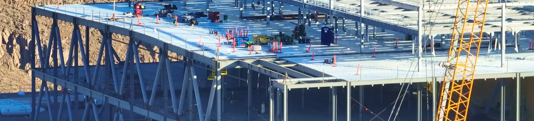
Most property managers run portfolios where every building needs regular condition documentation. Roofs, parking surfaces, building envelopes, HVAC equipment on rooftops. The traditional approach means scheduling multiple subcontractors, renting lifts or scaffolding, and waiting weeks for reports that are already outdated by the time they arrive. With DroneDeploy's aerial and ground-level capture, teams fly a site in minutes and walk interiors with 360 cameras, building a visual record that supports property condition assessments, maintenance planning and insurance documentation from a single platform.
Key Takeaways
- Cost Efficiency: Drones eliminate the need for manual surveys, significantly reducing maintenance budgets and inspection times.
- Comprehensive Inspections: High-resolution imagery identifies defects in roofs, pavement, HVAC systems, and building exteriors.
- Rapid Reporting: Tools like the Roof Report can turn drone maps into complete roof plans within 48 hours for insurance and repair estimates.
- Professional Pilot Network: Property managers can access a global network of certified pilots for on-demand data capture without hiring internal staff.
- Data-Driven Prioritization: Consistent mapping across portfolios allows managers to allocate funds based on objective Pavement Condition Index (PCI) scores.

How drones are used in property inspections
Whether the goal is a formal property condition assessment before a transaction or routine maintenance planning, the systems being evaluated are the same. Site improvements like parking lots and drainage. Structural elements. Building envelope and cladding. Roofing. MEP systems. Fire protection. Interior finishes. ADA compliance.
Traditionally, documenting each of those systems means coordinating multiple specialty contractors across multiple site visits. A drone captures the exterior condition of roofing, facades, HVAC equipment and pavement in a single flight. A 360 camera walk covers interior finishes, vertical transportation and life safety systems on the same day. The result is a timestamped visual record organized by location and date, available to every stakeholder reviewing the property.
A drone flight over a roof surfaces cracks, ponding areas, membrane damage and flashing failures in high-resolution imagery. The same flight produces accurate area measurements for repair scoping and insurance estimates. For parking lots and hardscape, aerial maps reveal block cracking, potholes, raveling and patching areas that inform a Pavement Condition Index score.
These maps become the baseline for capital planning. When a property changes hands or a lender requires due diligence documentation, the visual record already exists. Roofing contractors scope targeted repairs from the imagery instead of spending a full day on-site with ladders and lifts. Insurance adjusters reference timestamped captures to evaluate weather damage claims against documented pre-storm conditions.
Tools for coordinating inspections across property teams
Tracking deficiencies across your portfolio
When a drone flight or 360 walk reveals a deficiency, the finding gets pinned directly to the map at its exact location. Property managers tag the issue, assign it to the responsible party and set priority. Maintenance teams or contractors respond with comments, photos or status updates without needing a separate email thread or spreadsheet.
Over time, this builds a deficiency log tied to visual evidence and location data. For a portfolio with dozens or hundreds of properties, the same workflow applies at every site. Teams compare deficiency density across properties and allocate repair budgets based on documented conditions rather than guesswork. When a PCA consultant arrives for a formal assessment, the historical deficiency record provides context that supports their evaluation of remaining service life and capital expenditure forecasting.
Professional Services
Capture services for teams without in-house pilots
Some property management firms prefer to keep drone operations off their plate entirely. A network of certified pilots is available on-demand to fly properties per specific requirements. Pilots receive mission-specific training before arriving on site, and the data flows into the same platform where in-house teams already review their properties. This works well for organizations managing geographically dispersed portfolios where maintaining licensed pilots at every location would be impractical.

In a custom pavement report, DroneDeploy provides a Pavement Condition Index (PCI) Score and flags defects such as:
- Depressions and potholes
- Raveling and block cracking
- Asphalt curb or patching issues
Thermal reports add another layer to roof assessments. Where standard RGB imagery shows surface-level damage, thermal data reveals moisture intrusion and insulation failures beneath the membrane. Contractors scope targeted repairs from the thermal map, and the documentation supports insurance claims and capital expenditure projections for the property's remaining roof life. Both report types feed into the kind of structured property condition documentation that lenders and investors expect during due diligence.
Portfolio mapping and condition reporting
Building a consistent record across your portfolio
When every property gets captured with the same methodology, the data becomes comparable across sites. A portfolio manager reviewing 50 properties can sort by condition severity, compare year-over-year changes at the same locations and prioritize capital allocation based on documented need rather than anecdotal reports from site visits.
That consistency matters whether you are acquiring, holding or disposing of a property. During acquisition due diligence, a current visual record supplements or accelerates the formal PCA process by giving consultants baseline imagery before they arrive on site. For properties you hold, repeatable capture at regular intervals documents how conditions change over time, supporting capital expenditure forecasting. When it comes time to sell, a documented maintenance history with timestamped visual evidence strengthens your position during buyer due diligence. The record exists regardless of which team member captured it or when. It stays in one place, referenced by anyone who needs it.
Learn More
Next steps
If your team manages multiple properties and needs a repeatable way to document conditions across your portfolio, start with a single site. Fly the roof and parking surfaces, walk the interior with a 360 camera, and see what the record looks like when it lives in one place.
Book a demo to see how aerial and ground-level capture supports property condition documentation at portfolio scale.
.png)
FAQ
A property condition assessment (PCA) is a documented visual review of a property's major systems and components. Assessors walk the site and examine roofing, pavements, structural elements, building envelope and mechanical, electrical and plumbing (MEP) systems to identify deficiencies and estimate upcoming capital costs. The findings are compiled into a Property Condition Report (PCR), which owners, buyers and lenders use when making decisions about buying, selling or maintaining commercial real estate.
A Property Condition Report documents the physical condition of a property at a specific point in time. It typically covers roofing, pavements, structural systems, building envelope, MEP systems and life safety components. The report identifies existing deficiencies, estimates repair costs and projects when major systems will need replacement, giving stakeholders a clear picture of near- and long-term capital needs.
Drones capture high-resolution aerial imagery of roofs, pavements, facades and HVAC equipment without scaffolding or manual access. That data feeds directly into condition reports: a drone flight over a parking lot produces surface measurements and defect flags for a Pavement Condition Index (PCI) report, while thermal imaging of a roof identifies moisture intrusion and insulation failures that are difficult to detect from the ground. Property managers and assessors use that imagery as the documented record behind their capital planning decisions.
A PCA and an FCA are often referenced interchangeably, but the scope and purpose can differ. A PCA is typically tied to a real estate transaction or financing event and provides a baseline snapshot of physical condition at a point in time. An FCA tends to go deeper into system functionality, maintenance needs and regulatory compliance, and is more commonly used for ongoing facility management rather than a one-time transaction. Both assessments benefit from consistent aerial and ground-level documentation across a portfolio.


Ready to manage your data from the very start?
Book a quick call to see how DroneDeploy streamlines capture from construction through building ROI.