Photogrammetry software: complete guide for accurate 3D mapping and reconstruction
.svg)
Quick Summary
Photogrammetry software turns regular photos from phones or drones into accurate 3D models and measurements – making it ideal for construction, real estate, archaeology and more. It works by analyzing overlapping images to reconstruct real-world objects digitally. Platforms like DroneDeploy and Pix4D simplify this process, offering survey-grade results with less time and cost than traditional methods. Drones further enhance efficiency, capturing large areas safely and quickly. With growing use across industries, selecting the right software depends on your project scale, accuracy needs and budget.
Photogrammetry software turns regular photos into detailed 3D models and precise measurements. This proven technology lets you take pictures with your phone or drone and automatically create accurate digital copies of real-world objects, buildings, or entire construction sites.
This technology works by analyzing multiple digital images of the same thing taken from different angles. The software finds matching points between photos and calculates exactly where everything is in 3D space through 3D reconstruction algorithms. Industries from construction to real estate use this approach because it's faster and cheaper than traditional surveying methods.
Modern photogrammetry handles everything from smartphone snapshots to professional UAS images and aerial photogrammetry, creating results with survey-grade accuracy suitable for engineering projects and business decisions.
Understanding photogrammetry software and its core principles
Photogrammetry software takes multiple digital images of an object or area and combines them into a 3D reconstruction you can measure and analyze. The process works with any camera sensor - smartphones, tablets, regular cameras, or drones - without needing expensive laser scan technology or specialized equipment.
The software automatically finds matching features across your photos through computational photogrammetry algorithms, like corners of buildings or distinctive landmarks. By comparing how these features appear in different images, the program calculates their real-world positions and builds an accurate digital representation with geometry capture precision.
Popular software options like 3DF Zephyr and PIX4Dmatic handle this data processing automatically through their user interface. You simply upload your photo sets, and the software does the complex math to create detailed 3D models, maps, and measurements. The whole process that once required surveying teams and weeks of work now happens on your computer in hours.
Modern programs use AI photogrammetry and machine learning classification to make the process even smarter. The AI can automatically identify different types of objects - separating buildings from trees or equipment from permanent structures. This creates more accurate point cloud data and useful results for business decisions.
The main requirement is a decent computer with NVIDIA CUDA graphics capabilities to handle all the calculations efficiently. Processing time depends on how many photos you have, but most projects finish the same day you start them.
Applications of photogrammetry across professional industries
Photogrammetry software solves real problems across many industries by making accurate measurements and documentation faster and safer than traditional methods. Construction companies use it to track project progress without sending survey crews to dangerous areas through aerial photogrammetry and site inspection workflows. Real estate professionals create virtual tours and accurate property measurements for listings and development planning.
Archaeologists rely on photogrammetry for cultural heritage documentation, preserving historical sites and artifacts without disturbing them. The technology creates permanent digital records that researchers can study long after excavations are complete. Museums use the same approach for cultural heritage preservation in digital form.

Manufacturing companies use photogrammetry for reverse engineering - creating detailed CAD drawings and plans of existing products by photographing them from all angles. This approach helps with quality control, product improvements, and creating CAD-ready data for older equipment.
The technology works particularly well for these common business needs:
- Progress tracking on construction and infrastructure projects using aerial data
- Creating marketing materials for real estate and tourism with 3D modeling capabilities
- Quality control and product development in manufacturing through reality capture
- Documentation and preservation of historical sites and artifacts for GIS applications
- Volume calculations for mining, agriculture, and waste management with survey-grade data
What makes photogrammetry appealing is its accessibility. You don't need specialized training or expensive equipment to get started. Most software includes tutorials and automated features that guide you through the photogrammetric processing workflow.
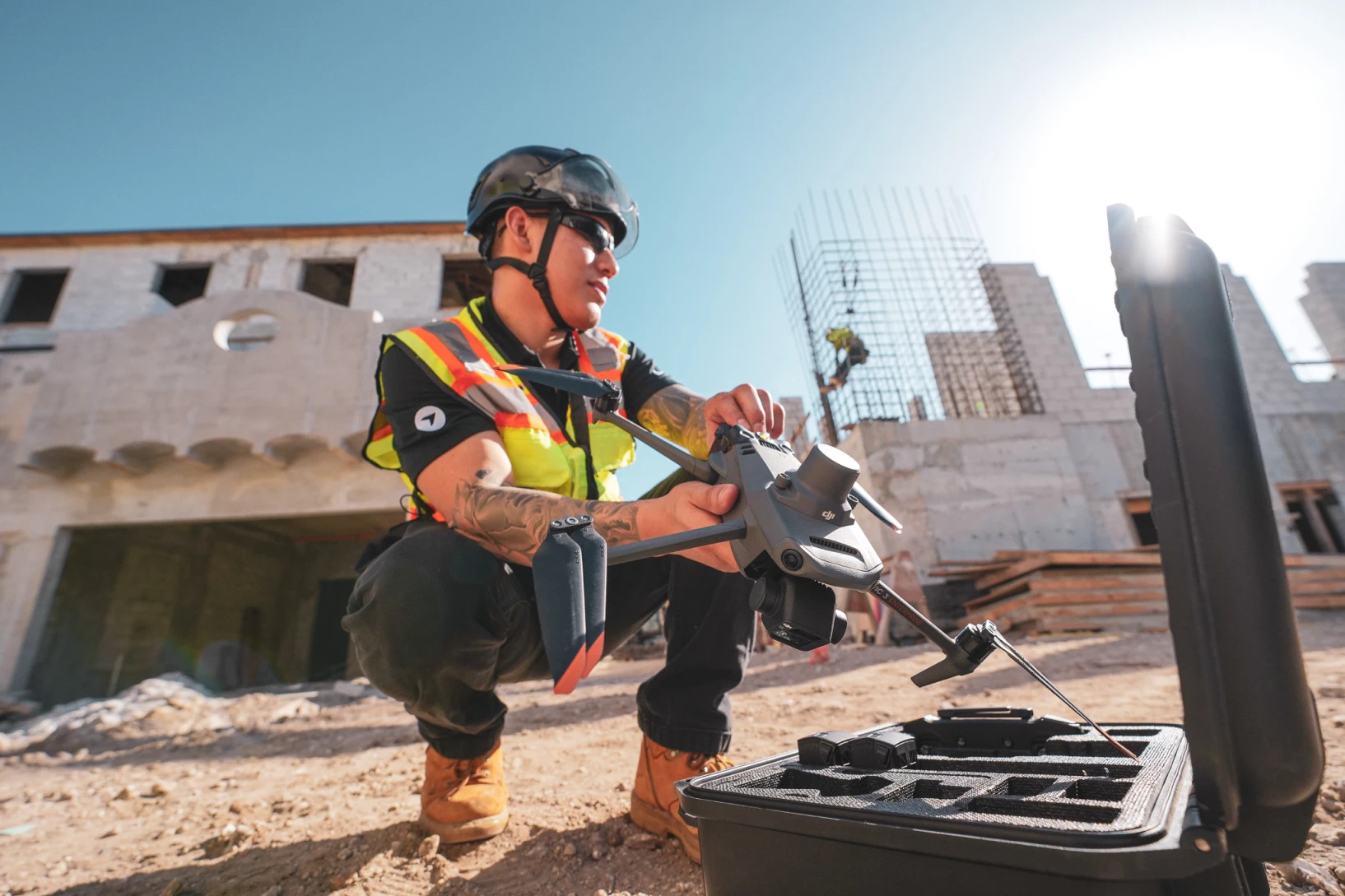
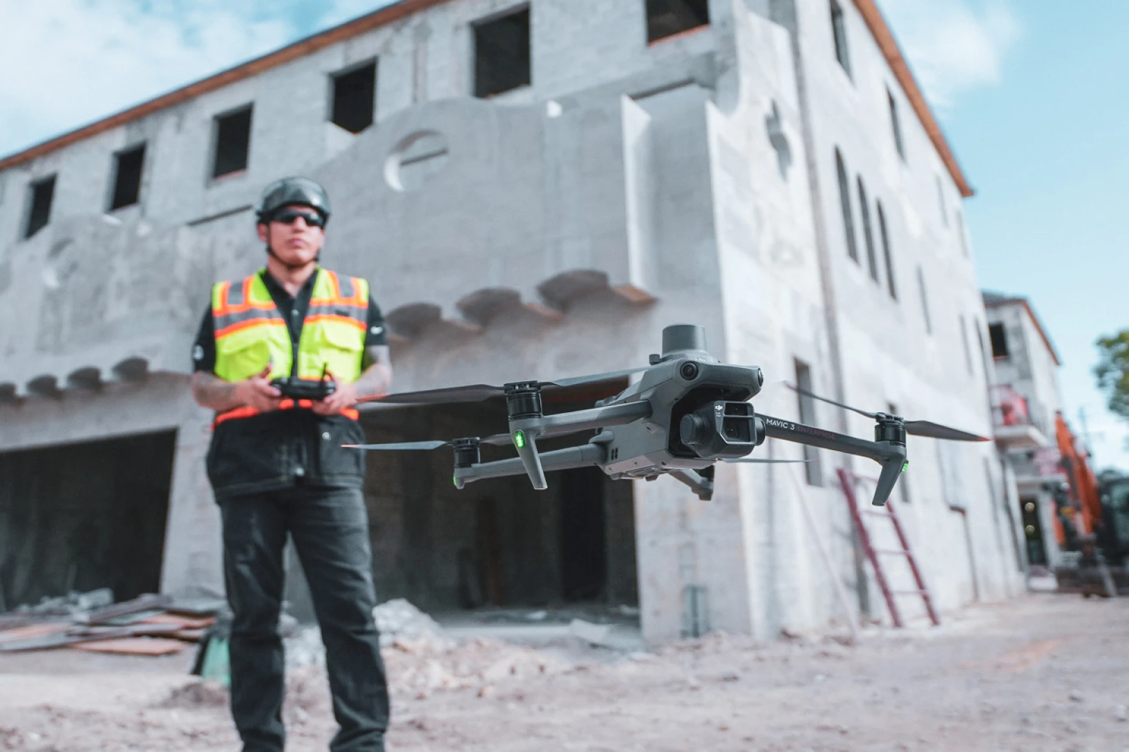
Drone mapping capabilities with advanced photogrammetry solutions
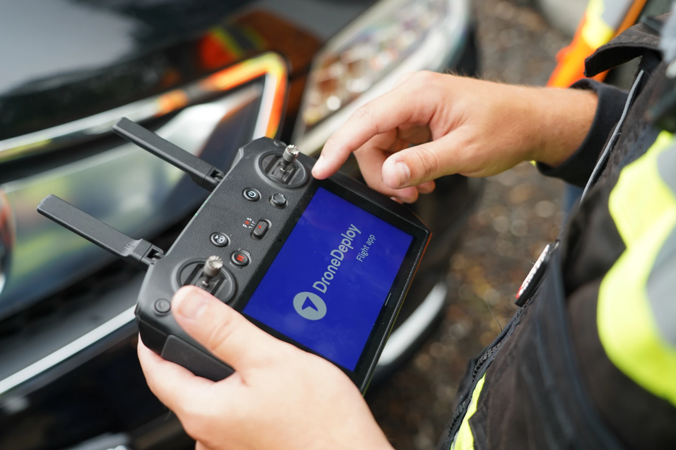
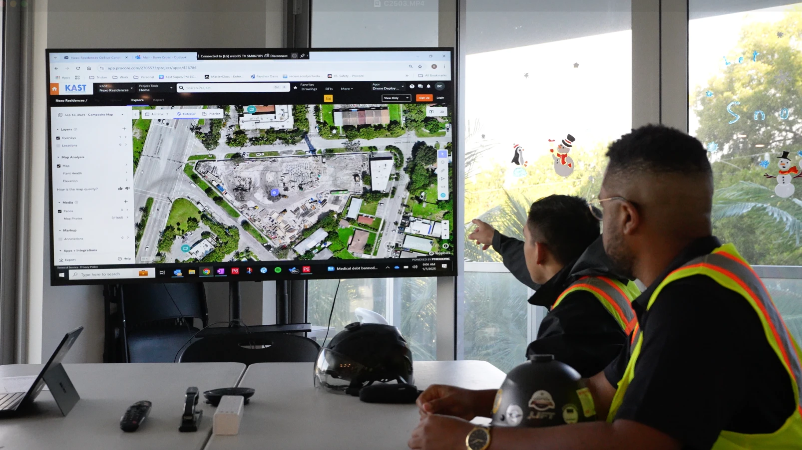
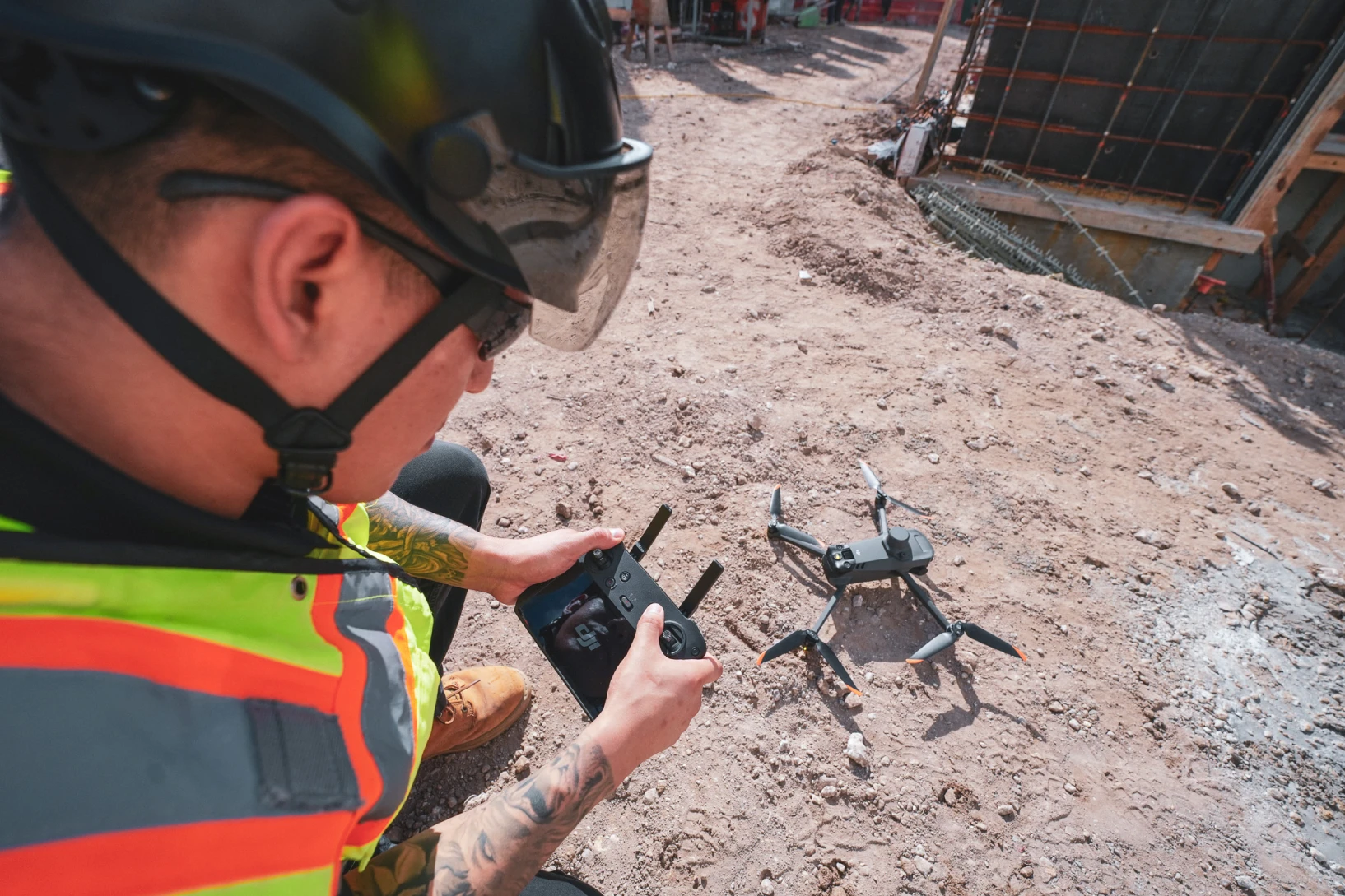
Drones have revolutionized photogrammetry by making it easy to capture aerial photos of large areas safely and efficiently. Software like Pix4D and DroneDeploy automatically converts drone photos into accurate maps and 3D models that businesses can use for planning and decision-making.
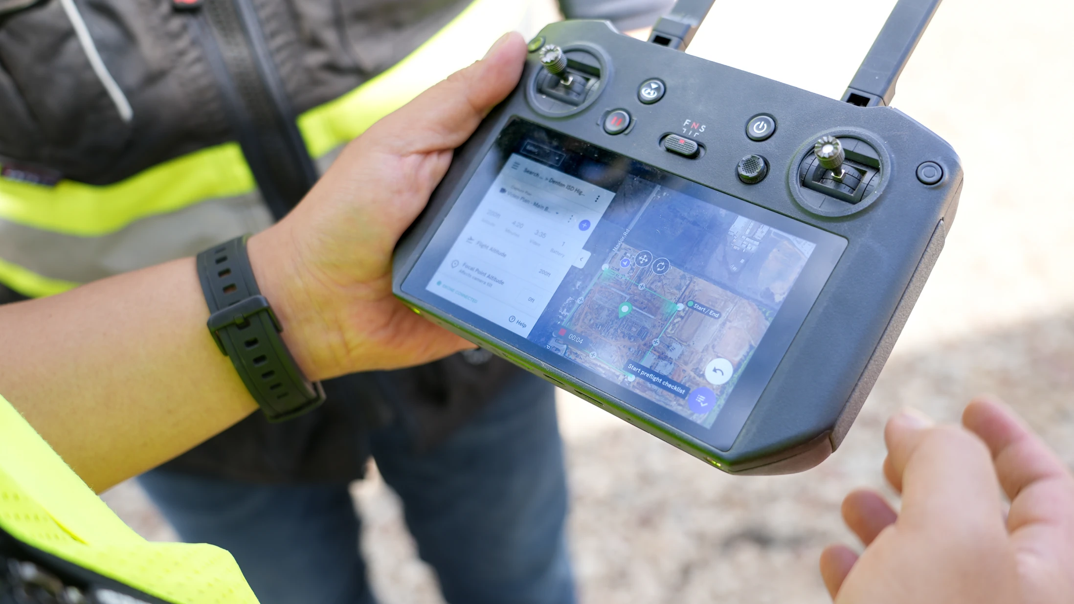
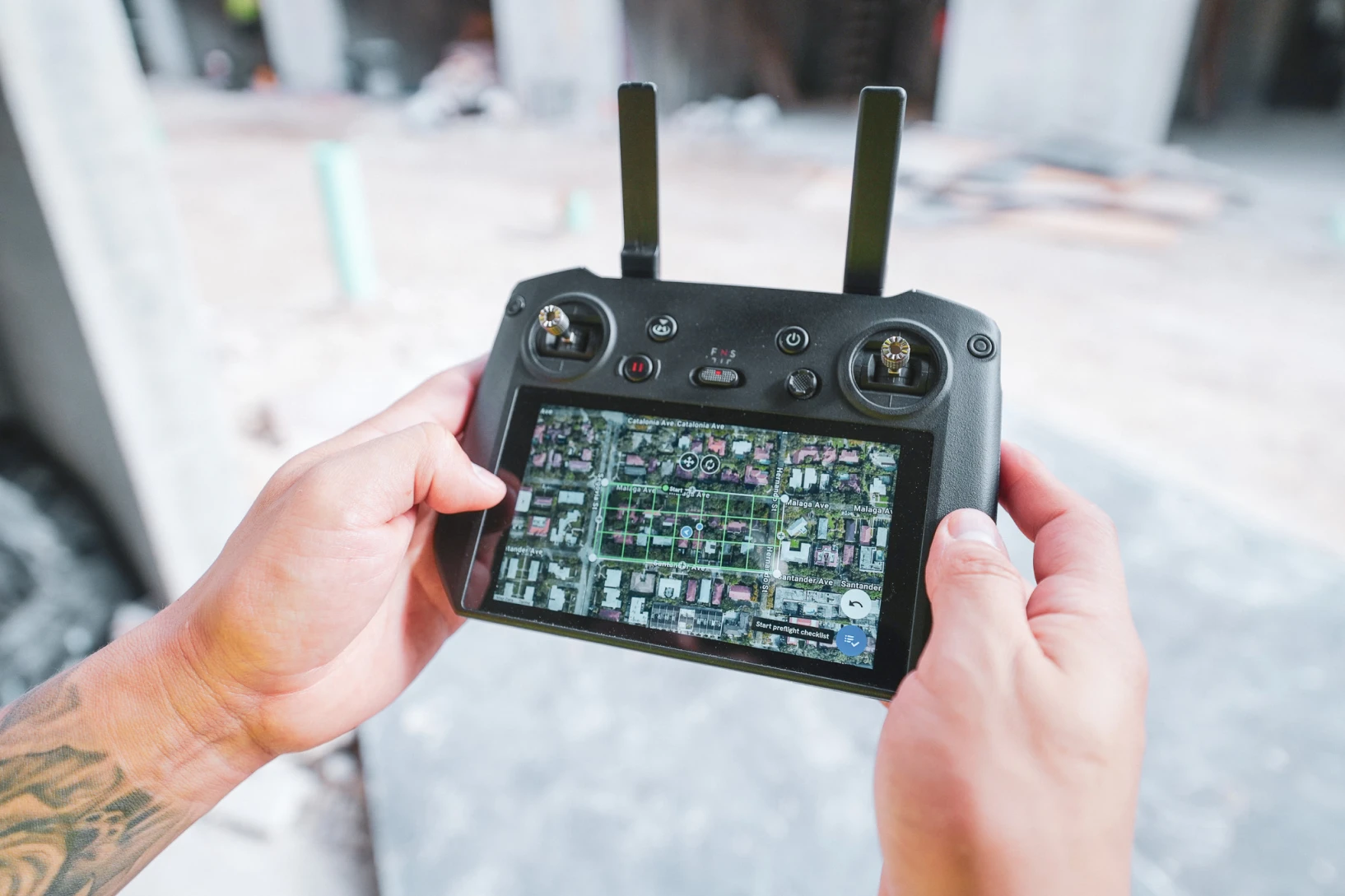
The process is straightforward: fly a drone over your area following a planned route, let it take hundreds of overlapping photos, then upload those images to photogrammetry software. The program creates detailed maps showing everything from property boundaries to stockpile volumes.
Specialized software like Pix4Dmatic handles thousands of drone photos at once, creating professional-quality maps and 3D models in just a few hours. This speed advantage means you can get up-to-date site information whenever you need it, rather than waiting weeks for traditional surveying results.
Advanced drone systems include GPS correction technology that makes the results accurate enough for official surveying and engineering work. When you add a few ground markers with known positions, the software can create maps that meet professional accuracy standards.
The biggest advantages of drone-based photogrammetry include:
- Complete site coverage in 20-30 minutes instead of days with ground crews
- Safe data collection from hazardous or hard-to-reach areas
- Regular updates that keep you informed about changing conditions
- Cost savings of 60-80% compared to traditional surveying methods
- Visual results that are easy for anyone to understand and use
Essential steps in the photogrammetry processing workflow
Creating 3D models with photogrammetry software follows a simple workflow that anyone can learn. The key is taking good photos with plenty of overlap - each part of your subject should appear in at least 3-4 different images from different angles. Proper camera calibration helps ensure accurate results.
Most post-processing software makes uploading easy with drag-and-drop functionality. Simply select all your digital images and drop them into the program. The software automatically organizes everything and starts looking for matching features between images, often supporting multiple file formats.
The program first performs image matching, where it identifies which photos show the same features from different viewpoints. Good photos with clear details make this step more accurate, while blurry or poorly lit images can cause problems. Some software includes control points and ground control points for enhanced accuracy.
Next comes feature extraction, where the software finds distinctive points that appear in multiple photos through computational photogrammetry. These might be corners of buildings, distinctive textures or natural landmarks. The more matching points the software finds, the better your final 3D textured mesh will be.
The final processing steps happen automatically using Multi View Stereo algorithms:
- The software calculates where each photo was taken from using camera tracking
- It determines the 3D position of every matching point creating 3D spatial data
- These points form a detailed point cloud representing your subject
- The program creates a textured 3D model you can measure and analyze
- Additional outputs like Digital Terrain and Surface models are generated as needed
Most projects finish processing in a few hours, depending on how many photos you started with. The software shows progress updates so you know when results are ready for export to various file formats.
Selecting the right photogrammetry software for your projects
Choosing photogrammetry software depends on what types of images you plan to process and what results you need. Some programs work better with aerial photogrammetry and UAS images, while others handle close-range photogrammetry for object documentation more effectively.
Consider your computer setup when selecting software. Some programs require powerful graphics cards with NVIDIA CUDA support and lots of memory, while others work fine on standard Microsoft Windows business computers. Most software companies provide system requirements to help you decide what will work.
Cost varies dramatically across different options. Free software like Meshroom provides basic functionality for personal projects, while professional solutions like Artec Studio, Autodesk ReCap Pro and Pix4Dmapper cost hundreds to thousands but include advanced features and technical support.
Think about these factors when comparing options:
- Ease of use: Some programs require technical knowledge while others feature intuitive user interface design
- Processing speed: Professional software typically handles large datasets faster through cloud processing service options
- Output compatibility: Make sure the software creates file formats compatible with your GIS, CAD & Survey Tools
- Accuracy requirements: Survey-grade accuracy costs more but may be necessary for your work
- Support and training: Professional packages include help when you need it
Popular choices include 3DF Zephyr for versatility and automation, RealityCapture for speed and precision, Agisoft Metashape for high-end professional work, and solutions like Autodesk ReCap for integration with existing CAD workflows. Cloud-based platforms like DroneDeploy eliminate the need for powerful local computers by processing everything online.
Budget and licensing considerations for professional photogrammetry software
Photogrammetry software pricing ranges from free open-source options to professional packages costing thousands of dollars. Free software like Meshroom works well for learning basics and small projects, while mid-range options like Polycam offer upgrades for business features and enhanced file formats support.
Professional software requires significant investment but delivers corresponding value through faster data processing, better accuracy, and comprehensive support. Agisoft Metashape Professional costs $3,499 for a permanent license, while subscription options like Pix4Dmapper and Artec Studio provide ongoing updates. Autodesk ReCap and other enterprise solutions offer integration with existing CAD and visual effects production workflows.
Cost planning factors for successful implementation
When planning your budget, consider several important factors beyond the initial software price. Software licenses vary between one-time purchases and monthly subscriptions that include ongoing support and access to cloud processing services. Computer hardware requirements may necessitate equipment upgrades, especially for graphics cards with NVIDIA CUDA support and memory needed to process large datasets efficiently.
Training time represents a hidden cost, as learning new post-processing software takes staff away from billable work during implementation. Many companies start with mid-range software to learn the photogrammetric processing workflow, then upgrade to professional solutions with advanced mesh editing tools and Python SDK capabilities as their needs grow. This approach spreads costs over time while building internal expertise with reality capture technology.
Ready to see photogrammetry in action for your specific projects? Request a demo of DroneDeploy's platform to see how automated processing and cloud-based workflows can streamline your documentation and measurement needs without the complexity of traditional software.
.png)
FAQ


.jpg)
Ready to manage your data from the very start?
Book a quick call to see how DroneDeploy streamlines capture from construction through building ROI.