%20(1).avif)
The only drone mapping software you’ll ever need
.png)


.png)


.png)


.png)
.png)

.png)
%201%20(2).png)


How DroneDeploy Aerial works
Try it yourself in this interactive preview
.avif)
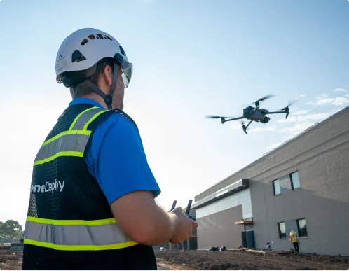
Build your fleet (or let us do it for you)
.avif)
Supported hardware
Our processing engine works with data from any camera source and supports automated flights, mission planning, and execution across drones, ground robots, docked systems, and 360 cameras.
Data on demand
Need the data but don't have pilots or hardware yet?
Use our services network to capture key corridors and facilities at the cadence you need, with processed maps, photos and models delivered straight into your DroneDeploy account.
Is DroneDeploy the right fit for your operations?
Project managers, site supervisors, survey professionals and operations teams use DroneDeploy Aerial to run consistent aerial documentation programs across construction, mining, oil and gas, solar, agriculture and infrastructure. Program directors managing multiple active sites, data and GIS teams integrating processed outputs, and mapping professionals with accuracy requirements will find the platform covers their program from flight to final deliverable.
DroneDeploy Aerial works with leading commercial hardware including DJI, Anzu, Freefly and more. The Supported Hardware page lists every recommended model, and the full supported drone list in the help center covers every compatible model – including those with automated flight control and mission planning.
DroneDeploy Aerial processes to sub-inch precision with RTK or PPK workflows. Accuracy is verified automatically after every flight. GCP support is available for projects with specific survey requirements.
Commercial drone operations in the US require FAA Part 107 certification. DroneDeploy supports pilot certification workflows through the platform. Teams without in-house pilots can use Data on Demand – DroneDeploy dispatches a certified, insured pilot to your site, typically within a week.
Most maps are processed automatically and available within minutes to a few hours of upload. There is no manual processing queue and no file hand-off. Maps, 3D models and annotated outputs are ready when your team is.
CAD and BIM overlay are built into the platform. Import your design files and compare them against current site conditions. This works across map views, 3D models and inspection outputs. Teams always work from a single reference that reflects the most recent flight.
The platform runs the same way whether you're managing one project or two hundred. Automated flight planning, consistent processing and centralized data storage keep the workflow consistent across every site. Portfolio-level reporting is available for program managers and executives.
Orthomosaic maps, 3D point clouds, digital surface models, thermal imagery, volumetric measurements and progress reports – depending on your camera and workflow. Data is shareable via the platform, exportable in standard formats or available through the API.
Construction, mining, oil and gas, solar, agriculture, utilities and infrastructure – any program that requires repeatable, accurate site documentation across multiple sites.
All data is encrypted in transit (TLS 1.2+) and at rest (AES-256). Infrastructure runs on AWS and Google Cloud with 24/7 monitoring. DroneDeploy is SOC 2 Type 1 and Type 2 certified and ISO 27001 compliant. For docked drone programs, the Firewall product extends that protection to the hardware itself.
DroneDeploy has built integrations with Esri ArcGIS, Procore, Autodesk and 40+ other platforms in the marketplace. Data exports in GeoTIFF, LAS, OBJ and other standard formats. Custom connections are available through the open API.
Getting started is simple. Request a demo today.